Elected Officials
Courts
Departments
Initiatives
Open Government
About
Login / Register
Home
/
Property & Tax Records
/
Property Records
/
Property & Tax Search
/
Parcel Profile
/
Print View
Search for Another Parcel
Parcel Profile
Historical Card
Sketches
Photos
Tax Map
Taxes
Print View
Print This Page
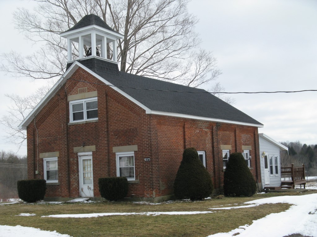
Address: 10373 SAMPSON RD
Parcel: 25025064001800
Parcel Profile
Address
10373 | SAMPSON | RD
Street Status
PAVED
School District
WATTSBURG SCHOOL
Acreage
0.4053
Classification
R
Land Use Code
SINGLE FAMILY
Legal Description
10373 SAMPSON RD 165 X 107
Square Feet
1706
Topo
LEVEL
Utility
WELL | SEPTIC
Zoning
Please contact your municipal zoning officer
Deed Book
2013
Deed Page
001326
2026 Tax Values
Land Value / Taxable
32,800 / 200.00
Building Value / Taxable
67,000 / 67,000.00
Total Value / Taxable
99,800 / 67,200.00
Clean & Green
Active
Homestead Status
Active
Farmstead Status
Inactive
Lerta Amount
0
Lerta Expiration Year
0
Residential Data
Card 1
Style
OTHER
Basement
NONE
Year Built
1900
Exterior Wall
BRICK
Total Living Area
1706
Full Baths
1
Half Baths
0
Fuel Type
GAS
Heating
CENTRAL
Heating System
HOT WATER
Stories
1.0
Total Bedrooms
2
Total Family Rooms
1
Total Rooms
7
Fireplaces
0
Other Buildings & Yards
No OBY Data Found
Sales History
Sale Date
Type
Price
Book / Page
Other Info
1/16/2013
LAND & BUILDING
0
2013 / 001326
SPECIAL WARRANTY DEED
2/2/2012
LAND & BUILDING
0
2012 / 002982
SPECIAL WARRANTY DEED
12/27/2002
LAND & BUILDING
0
0961 / 0253
AFFIDAVIT
Parcel Sketches
Residential Card 1
A
MAIN
1008 square feet
B
MA_PT CONC/MAS PATIO
72 square feet
C
1S FR ONE STORY FRAME
144 square feet
D
FR UT FRAME UTILITY BUILDING
192 square feet
E
WDDCK WOOD DECKS
128 square feet
Parcel Images
Please note:
this tab is for informational purposes only and may not show all delinquencies, see the Taxes tab for more accurate delinquent taxes due.