Elected Officials
Courts
Departments
Initiatives
Open Government
About
Login / Register
Home
/
Property & Tax Records
/
Property Records
/
Property & Tax Search
/
Parcel Profile
/
Print View
Search for Another Parcel
Parcel Profile
Historical Card
Sketches
Photos
Tax Map
Taxes
Print View
Print This Page
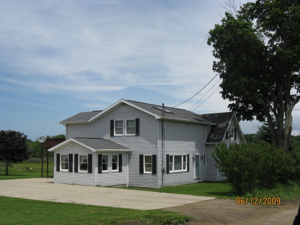
Address: 11278 RICH HILL RD
Parcel: 26003011001200
Parcel Profile
Address
11278 | RICH HILL | RD
Street Status
UNPAVED
School District
WATTSBURG SCHOOL
Acreage
5.0750
Classification
R
Land Use Code
SINGLE FAMILY
Legal Description
11278 RICH HILL RD 5.075 AC NET | 5.342AC
Square Feet
2213
Topo
LEVEL
Utility
GAS | WELL | SEPTIC
Zoning
Please contact your municipal zoning officer
Deed Book
2025
Deed Page
001210
2026 Tax Values
Land Value / Taxable
40,600 / 40,600.00
Building Value / Taxable
88,100 / 88,100.00
Total Value / Taxable
128,700 / 128,700.00
Clean & Green
Inactive
Homestead Status
Inactive
Farmstead Status
Inactive
Lerta Amount
0
Lerta Expiration Year
0
Residential Data
Card 1
Style
CONVENTIONAL
Basement
FULL
Year Built
1900
Exterior Wall
ALUMINUM/VINYL
Total Living Area
2213
Full Baths
1
Half Baths
1
Fuel Type
GAS
Heating
CENTRAL A/C
Heating System
FORCED AIR
Stories
1.5
Total Bedrooms
4
Total Family Rooms
0
Total Rooms
7
Fireplaces
0
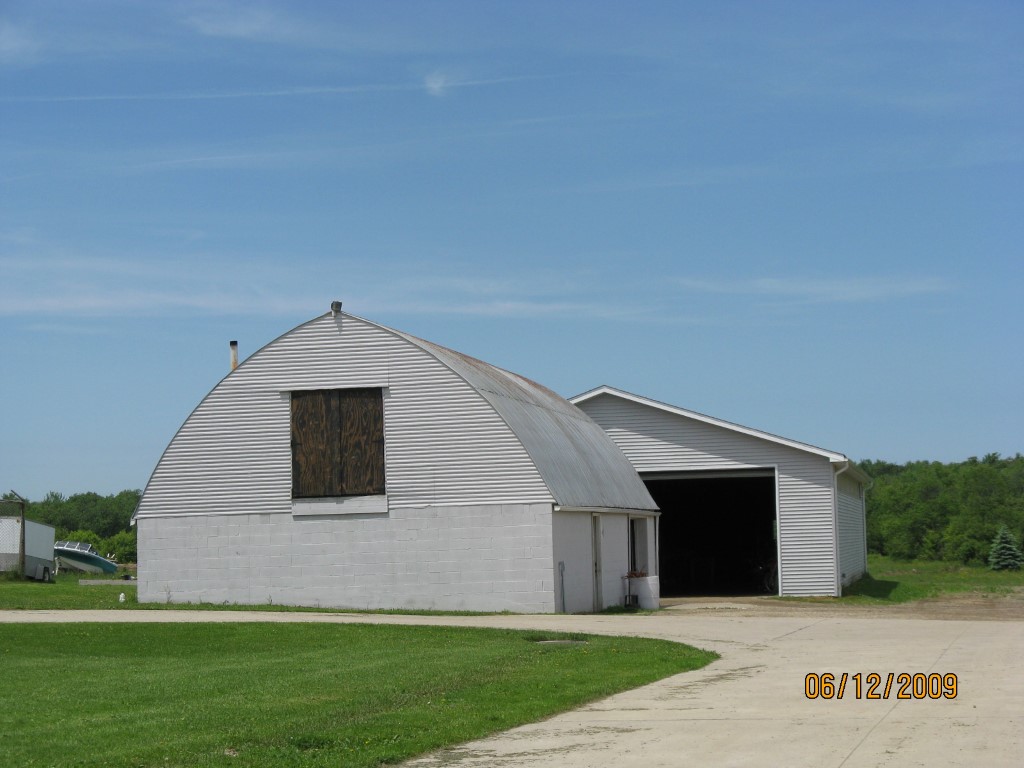
Other Buildings & Yards
Description
Built
Width
Length
Area
FLAT BARN
1900
27
45
1215
FLAT BARN
1900
40
79
3160
Sales History
Sale Date
Type
Price
Book / Page
Other Info
1/24/2025
LAND & BUILDING
92388
2025 / 001210
DEED
7/26/2018
LAND & BUILDING
144000
2018 / 015073
DEED
2/26/2003
LAND & BUILDING
0
0980 / 0965
AFFIDAVIT
11/15/1993
0
0303 / 0444
Parcel Sketches
Residential Card 1
A
MAIN
1118 square feet
B
OFP OPEN FRAME PORCH WDDCK WOOD DECKS
168 square feet
C
WDDCK WOOD DECKS
432 square feet
D
EFP ENCL FRAME PORCH
168 square feet
E
MA_PT CONC/MAS PATIO
144 square feet
F
1S FR ONE STORY FRAME
256 square feet
Parcel Images
Please note:
this tab is for informational purposes only and may not show all delinquencies, see the Taxes tab for more accurate delinquent taxes due.