Elected Officials
Courts
Departments
Initiatives
Open Government
About
Login / Register
Home
/
Property & Tax Records
/
Property Records
/
Property & Tax Search
/
Parcel Profile
/
Print View
Search for Another Parcel
Parcel Profile
Historical Card
Sketches
Photos
Tax Map
Taxes
Print View
Print This Page
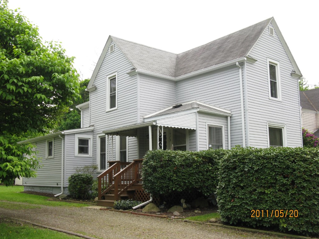
Address: 1975 DEPOT RD
Parcel: 27033127002700
Parcel Profile
Address
1975 | DEPOT | RD
Street Status
PAVED
School District
HARBOR CREEK
Acreage
0.1607
Classification
R
Land Use Code
SINGLE FAMILY
Legal Description
1975 DEPOT RD TR H | 50X140
Square Feet
1480
Topo
LEVEL
Utility
PUBLIC WATER | GAS | SEPTIC
Zoning
Please contact your municipal zoning officer
Deed Book
0917
Deed Page
2393
2026 Tax Values
Land Value / Taxable
28,300 / 28,300.00
Building Value / Taxable
51,500 / 51,500.00
Total Value / Taxable
79,800 / 79,800.00
Clean & Green
Inactive
Homestead Status
Active
Farmstead Status
Inactive
Lerta Amount
0
Lerta Expiration Year
0
Residential Data
Card 1
Style
OLD STYLE
Basement
FULL
Year Built
1900
Exterior Wall
COMPOSITION
Total Living Area
1480
Full Baths
1
Half Baths
0
Fuel Type
GAS
Heating
CENTRAL
Heating System
FORCED AIR
Stories
2.0
Total Bedrooms
3
Total Family Rooms
1
Total Rooms
10
Fireplaces
0
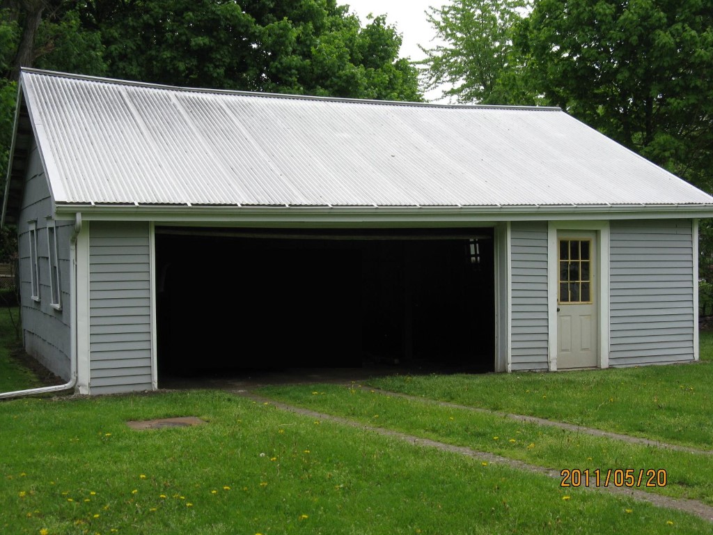
Other Buildings & Yards
Description
Built
Width
Length
Area
FRAME OR CB DETACHED GARAGE
1916
24
31
744
Sales History
Sale Date
Type
Price
Book / Page
Other Info
9/6/2002
LAND & BUILDING
0
0917 / 2393
QUIT CLAIM DEED
2/12/1974
0
1113 / 0556
Parcel Sketches
Residential Card 1
A
MAIN
616 square feet
B
OFP OPEN FRAME PORCH
60 square feet
C
1S FR ONE STORY FRAME
60 square feet
D
1S FR ONE STORY FRAME
188 square feet
Parcel Images
Please note:
this tab is for informational purposes only and may not show all delinquencies, see the Taxes tab for more accurate delinquent taxes due.