Elected Officials
Courts
Departments
Initiatives
Open Government
About
Login / Register
Home
/
Property & Tax Records
/
Property Records
/
Property & Tax Search
/
Parcel Profile
/
Print View
Search for Another Parcel
Parcel Profile
Historical Card
Sketches
Photos
Tax Map
Taxes
Print View
Print This Page
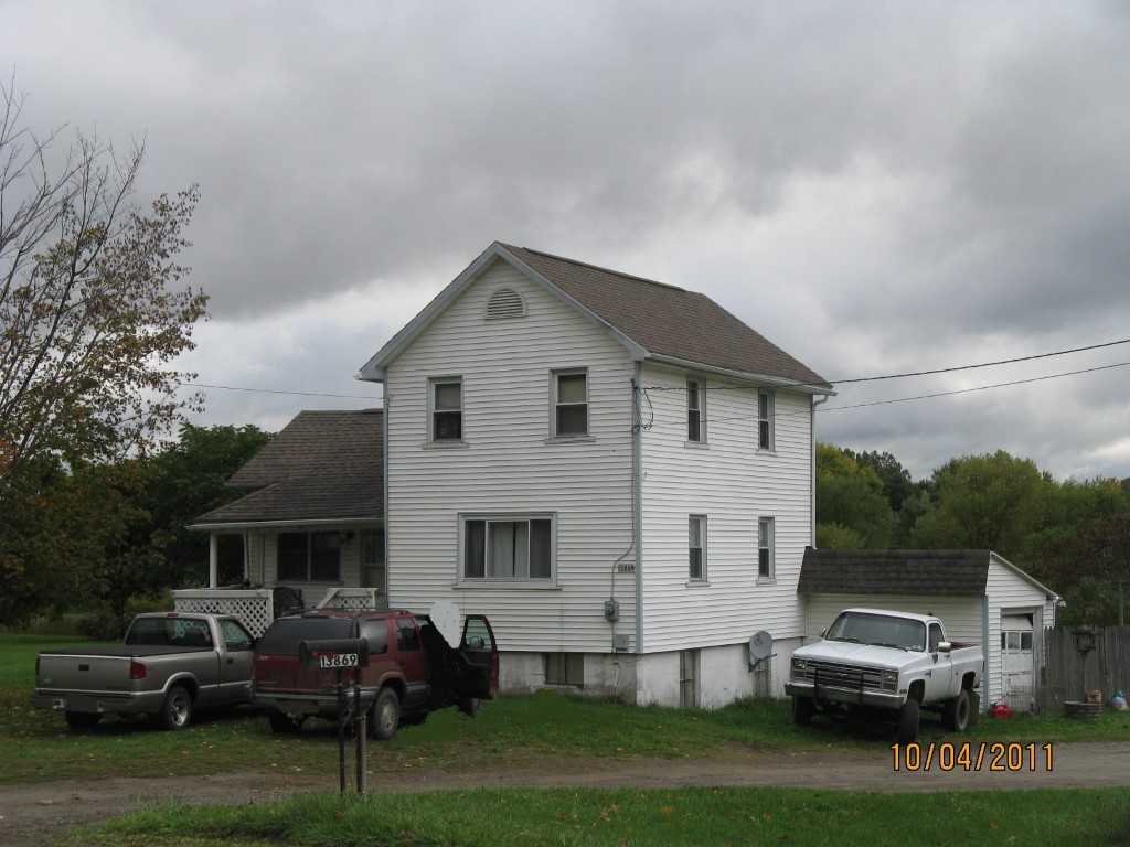
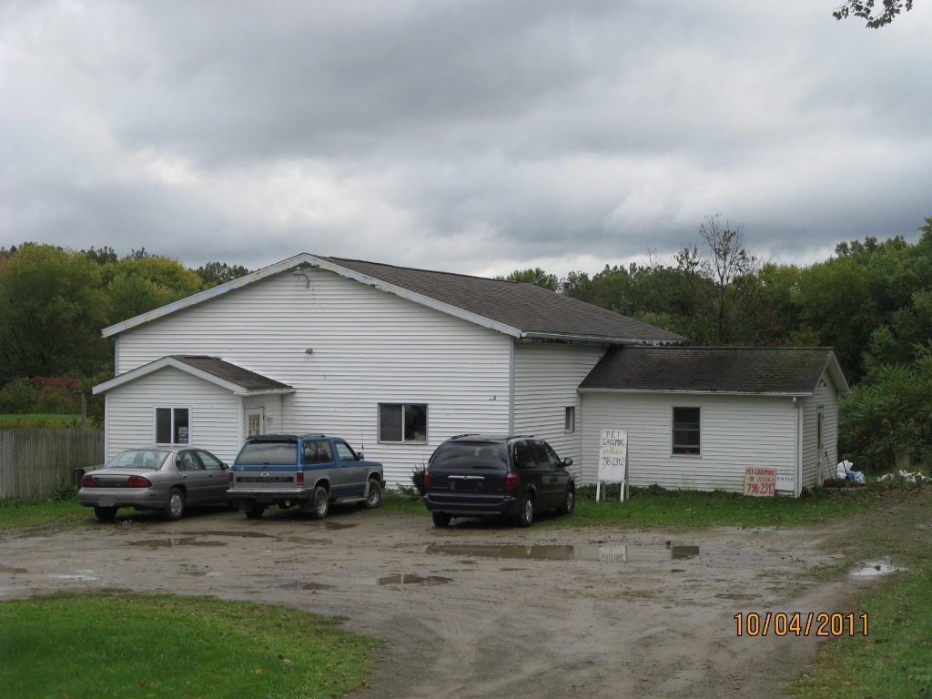
Address: 13869 ROUTE 19
Parcel: 30012031002701
Parcel Profile
Address
13869 | ROUTE 19
Street Status
PAVED
School District
FORT LEBOEUF SCHOOL
Acreage
1.0370
Classification
C
Land Use Code
RESTAURANTS, STORES (RETAIL)
Legal Description
13869 ROUTE 19 1.037 AC NET
Square Feet
4066
Topo
LEVEL
Utility
GAS | WELL | SEPTIC
Zoning
Please contact your municipal zoning officer
Deed Book
2021
Deed Page
022334
2026 Tax Values
Land Value / Taxable
20,100 / 20,100.00
Building Value / Taxable
60,500 / 60,500.00
Total Value / Taxable
80,600 / 80,600.00
Clean & Green
Inactive
Homestead Status
Inactive
Farmstead Status
Inactive
Lerta Amount
0
Lerta Expiration Year
0
Commercial Data
Card 1
RESIDENTIAL 1 FAMILY
Business Living Area - 2014
Year Built - 1912
Improvement Name - WEECARE DAY CARE
Value - 23120
Card 2
DAY CARE CENTER
Business Living Area - 2052
Year Built - 1990
Improvement Name - WEECARE DAYCARE
Value - 37420
Other Buildings & Yards
No OBY Data Found
Sales History
Sale Date
Type
Price
Book / Page
Other Info
8/20/2021
LAND & BUILDING
0
2021 / 022334
SPECIAL WARRANTY DEED
11/30/2010
LAND & BUILDING
70500
2010 / 029910
FIDUCIARY DEED
7/18/1989
0
0092 / 1934
Parcel Sketches
Commercial Card 1
A
MAIN
431 square feet
B
MAIN
431 square feet
C
MAIN
384 square feet
D
MAIN
384 square feet
E
MAIN
384 square feet
Commercial Card 2
A
MAIN
2052 square feet
Parcel Images
Please note:
this tab is for informational purposes only and may not show all delinquencies, see the Taxes tab for more accurate delinquent taxes due.