Elected Officials
Courts
Departments
Initiatives
Open Government
About
Login / Register
Home
/
Property & Tax Records
/
Property Records
/
Property & Tax Search
/
Parcel Profile
/
Print View
Search for Another Parcel
Parcel Profile
Historical Card
Sketches
Photos
Tax Map
Taxes
Print View
Print This Page
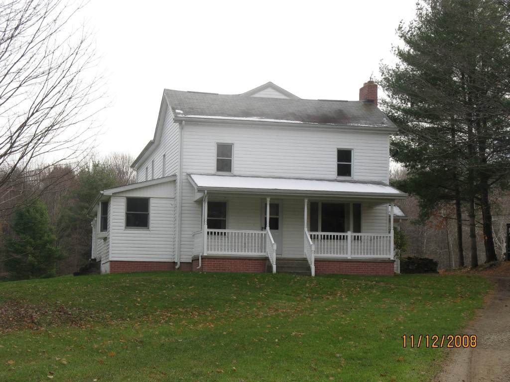
Address: 14909 MACKEY HILL RD
Parcel: 30019082001400
Parcel Profile
Address
14909 | MACKEY HILL | RD
Street Status
PAVED
School District
FORT LEBOEUF SCHOOL
Acreage
79.5100
Classification
F
Land Use Code
20 - 79.99 ACRES
Legal Description
14909 MACKEY HILL RD 79.513 AC
Square Feet
2988
Topo
ROLLING
Utility
WELL | SEPTIC
Zoning
Please contact your municipal zoning officer
Deed Book
0341
Deed Page
0980
2026 Tax Values
Land Value / Taxable
113,100 / 113,100.00
Building Value / Taxable
105,300 / 105,300.00
Total Value / Taxable
218,400 / 218,400.00
Clean & Green
Inactive
Homestead Status
Active
Farmstead Status
Inactive
Lerta Amount
0
Lerta Expiration Year
0
Residential Data
Card 1
Style
OLD STYLE
Basement
PART
Year Built
1900
Exterior Wall
ALUMINUM/VINYL
Total Living Area
2988
Full Baths
2
Half Baths
0
Fuel Type
OIL
Heating
CENTRAL
Heating System
HOT WATER
Stories
2.0
Total Bedrooms
4
Total Family Rooms
0
Total Rooms
9
Fireplaces
0
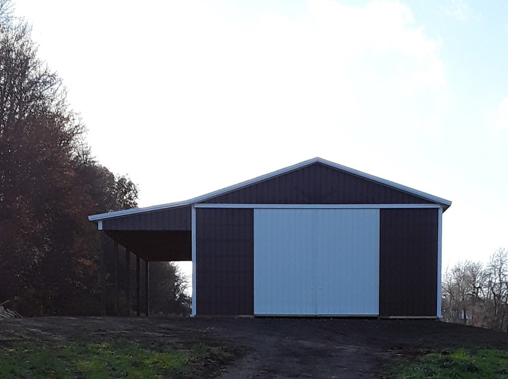
Other Buildings & Yards
Description
Built
Width
Length
Area
FOUR SIDE CLOSED MTL POLE BLDG
1991
30
70
2100
FOUR SIDE CLOSED MTL POLE BLDG
2021
32
40
1280
1S LEAN TO
2021
12
40
480
Sales History
Sale Date
Type
Price
Book / Page
Other Info
6/22/1994
0
0341 / 0980
Parcel Sketches
Residential Card 1
A
MAIN
1274 square feet
B
1S FR ONE STORY FRAME
248 square feet
C
1S FR ONE STORY FRAME
192 square feet
D
EFP ENCL FRAME PORCH
48 square feet
E
OFP OPEN FRAME PORCH
208 square feet
F
FR GR FRAME GARAGE
832 square feet
Parcel Images
Please note:
this tab is for informational purposes only and may not show all delinquencies, see the Taxes tab for more accurate delinquent taxes due.