Elected Officials
Courts
Departments
Initiatives
Open Government
About
Login / Register
Home
/
Property & Tax Records
/
Property Records
/
Property & Tax Search
/
Parcel Profile
/
Print View
Search for Another Parcel
Parcel Profile
Historical Card
Sketches
Photos
Tax Map
Taxes
Print View
Print This Page
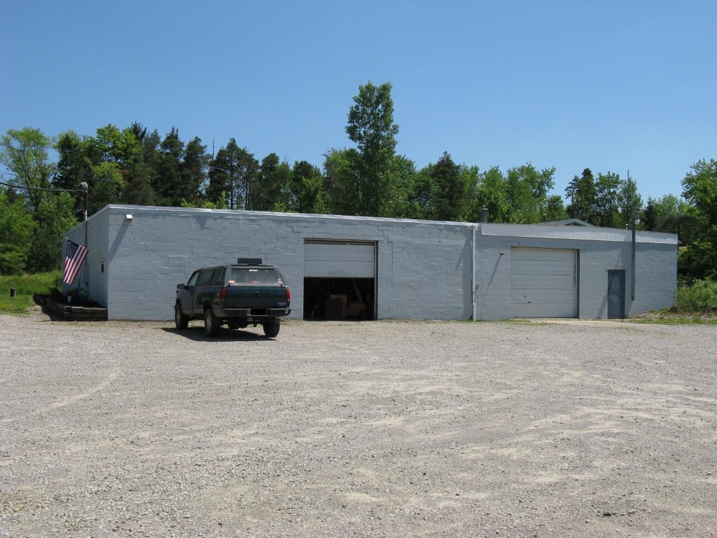
Address: 6543 STERRETTANIA RD
Parcel: 31001020001600
Parcel Profile
Address
6543 | STERRETTANIA | RD
Street Status
PAVED
School District
GENERAL MCLANE SCHOOL
Acreage
1.0000
Classification
C
Land Use Code
RESTAURANTS, STORES (RETAIL)
Legal Description
6543 STERRETTANIA RD 1 AC
Square Feet
6776
Topo
LEVEL
Utility
GAS | WELL | SEPTIC
Zoning
Please contact your municipal zoning officer
Deed Book
2022
Deed Page
000131
2026 Tax Values
Land Value / Taxable
30,000 / 30,000.00
Building Value / Taxable
123,800 / 123,800.00
Total Value / Taxable
153,800 / 153,800.00
Clean & Green
Inactive
Homestead Status
Inactive
Farmstead Status
Inactive
Lerta Amount
0
Lerta Expiration Year
0
Commercial Data
Card 1
MFG/PROCESSING
Business Living Area - 5304
Year Built - 1967
Improvement Name - CASCADE TOOL
Value - 62650
Card 2
RETAIL SINGLE OCCUP
Business Living Area - 1472
Year Built - 1970
Improvement Name -
Value - 19900
Other Buildings & Yards
No OBY Data Found
Sales History
Sale Date
Type
Price
Book / Page
Other Info
1/3/2022
LAND & BUILDING
255000
2022 / 000131
DEED
10/26/1999
LAND & BUILDING
150000
0670 / 0736
Parcel Sketches
Commercial Card 1
A
MAIN
2304 square feet
B
MAIN
2232 square feet
C
MAIN
768 square feet
Commercial Card 2
A
MAIN
1472 square feet
Parcel Images
Please note:
this tab is for informational purposes only and may not show all delinquencies, see the Taxes tab for more accurate delinquent taxes due.