Elected Officials
Courts
Departments
Initiatives
Open Government
About
Login / Register
Home
/
Property & Tax Records
/
Property Records
/
Property & Tax Search
/
Parcel Profile
/
Print View
Search for Another Parcel
Parcel Profile
Historical Card
Sketches
Photos
Tax Map
Taxes
Print View
Print This Page
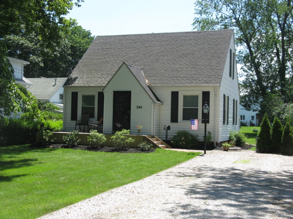
Address: 3411 W 10 ST
Parcel: 33028077000600
Parcel Profile
Address
3411 | W | 10 | ST
Street Status
PAVED
School District
MILLCREEK SCHOOL
Acreage
0.2038
Classification
R
Land Use Code
SINGLE FAMILY
Legal Description
3411 W 10 ST 53 X 167.5
Square Feet
1051
Topo
LEVEL
Utility
ALL PUBLIC
Zoning
Please contact your municipal zoning officer
Deed Book
2010
Deed Page
021335
2026 Tax Values
Land Value / Taxable
21,900 / 21,900.00
Building Value / Taxable
79,080 / 79,080.00
Total Value / Taxable
100,980 / 100,980.00
Clean & Green
Inactive
Homestead Status
Active
Farmstead Status
Inactive
Lerta Amount
0
Lerta Expiration Year
0
Residential Data
Card 1
Style
CAPE
Basement
FULL
Year Built
1941
Exterior Wall
ALUMINUM/VINYL
Total Living Area
1051
Full Baths
1
Half Baths
0
Fuel Type
GAS
Heating
CENTRAL A/C
Heating System
FORCED AIR
Stories
1.0
Total Bedrooms
3
Total Family Rooms
1
Total Rooms
6
Fireplaces
0
Other Buildings & Yards
Description
Built
Width
Length
Area
FRAME UTILITY SHED
1970
10
12
120
Sales History
Sale Date
Type
Price
Book / Page
Other Info
8/30/2010
LAND & BUILDING
103450
2010 / 021335
SPECIAL WARRANTY DEED
8/18/2006
LAND & BUILDING
100000
1355 / 1728
FIDUCIARY DEED
3/27/1972
0
1064 / 0458
Parcel Sketches
Residential Card 1
A
MAIN
728 square feet
B
WDDCK WOOD DECKS
130 square feet
C
1S FR ONE STORY FRAME
32 square feet
D
WDDCK WOOD DECKS
192 square feet
Parcel Images
Please note:
this tab is for informational purposes only and may not show all delinquencies, see the Taxes tab for more accurate delinquent taxes due.