Elected Officials
Courts
Departments
Initiatives
Open Government
About
Login / Register
Home
/
Property & Tax Records
/
Property Records
/
Property & Tax Search
/
Parcel Profile
/
Print View
Search for Another Parcel
Parcel Profile
Historical Card
Sketches
Photos
Tax Map
Taxes
Print View
Print This Page
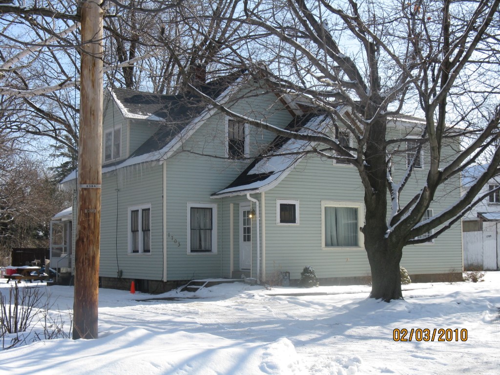
Address: 1703 GORMAN DR
Parcel: 33039146000105
Parcel Profile
Address
1703 | GORMAN | DR
Street Status
PAVED
School District
MILLCREEK SCHOOL
Acreage
0.4270
Classification
E
Land Use Code
EXEMPT SERVICE CONNECTED (VETERANS)
Legal Description
1703 GORMAN DR LOT F 90 X 234.49 IRR
Square Feet
2477
Topo
LEVEL
Utility
ALL PUBLIC
Zoning
Please contact your municipal zoning officer
Deed Book
0376
Deed Page
2046
2026 Tax Values
Land Value / Taxable
25,100 / 25,100.00
Building Value / Taxable
117,200 / 117,200.00
Total Value / Taxable
142,300 / 142,300.00
Clean & Green
Inactive
Homestead Status
Inactive
Farmstead Status
Inactive
Lerta Amount
0
Lerta Expiration Year
0
Residential Data
Card 1
Style
CONVENTIONAL
Basement
FULL
Year Built
1927
Exterior Wall
ALUMINUM/VINYL
Total Living Area
2477
Full Baths
3
Half Baths
0
Fuel Type
GAS
Heating
CENTRAL
Heating System
FORCED AIR
Stories
2.0
Total Bedrooms
5
Total Family Rooms
0
Total Rooms
8
Fireplaces
0
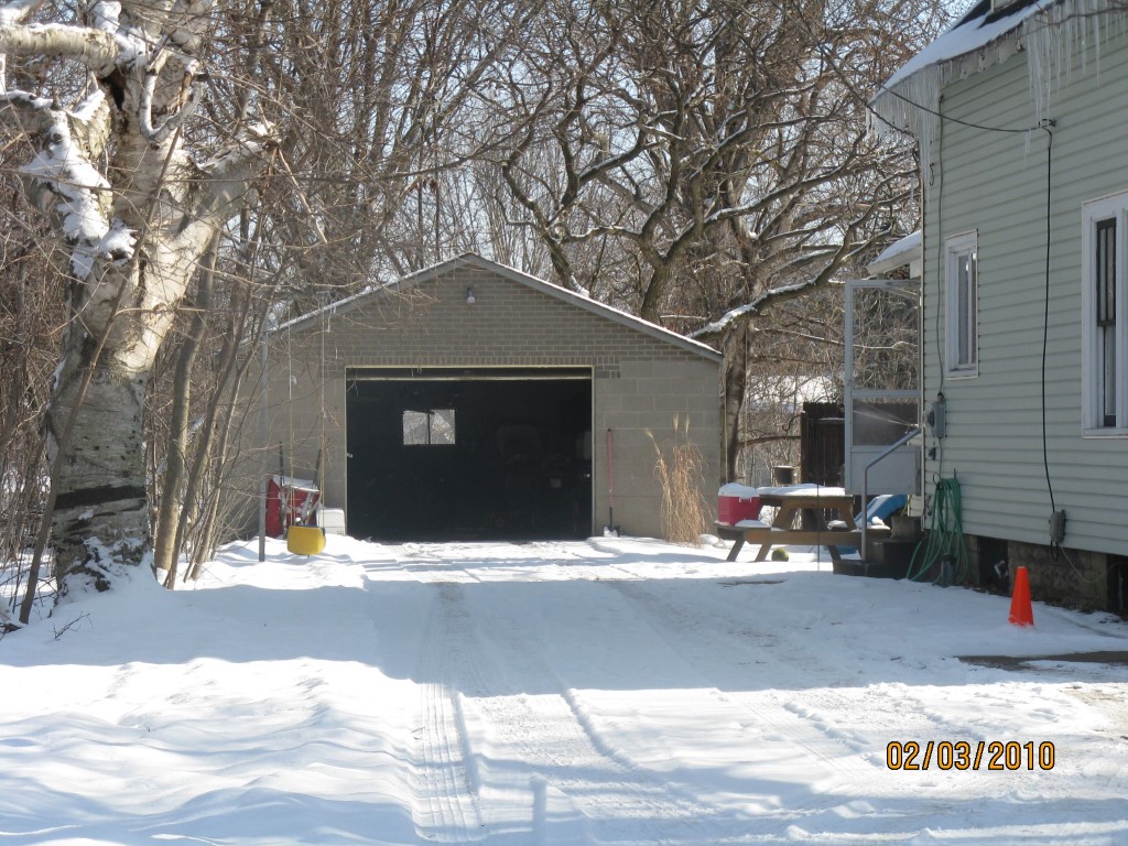
Other Buildings & Yards
Description
Built
Width
Length
Area
FRAME OR CB DETACHED GARAGE
1950
28
20
560
Sales History
Sale Date
Type
Price
Book / Page
Other Info
3/23/1995
0
0376 / 2046
Parcel Sketches
Residential Card 1
A
MAIN
621 square feet
B
UNFIN BSMT BASEMENT UNFINISHED 1S FR ONE STORY FRAME AT FN ATTIC-FINISHED
128 square feet
C
EFP ENCL FRAME PORCH
80 square feet
D
1S FR ONE STORY FRAME 1S FR ONE STORY FRAME
528 square feet
Parcel Images
Please note:
this tab is for informational purposes only and may not show all delinquencies, see the Taxes tab for more accurate delinquent taxes due.