Elected Officials
Courts
Departments
Initiatives
Open Government
About
Login / Register
Home
/
Property & Tax Records
/
Property Records
/
Property & Tax Search
/
Parcel Profile
/
Print View
Search for Another Parcel
Parcel Profile
Historical Card
Sketches
Photos
Tax Map
Taxes
Print View
Print This Page
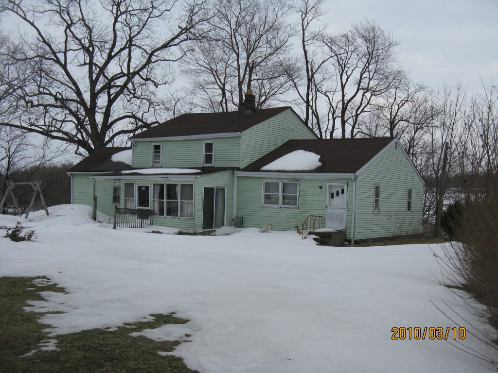
Address: 5025 WATTSBURG RD
Parcel: 33106477004300
Parcel Profile
Address
5025 | WATTSBURG | RD
Street Status
PAVED
School District
MILLCREEK SCHOOL
Acreage
1.7400
Classification
R
Land Use Code
SINGLE FAMILY
Legal Description
5025 WATTSBURG RD 1.74 AC CAL
Square Feet
2505
Topo
ABOVE STREET
Utility
PUBLIC WATER | GAS | SEPTIC
Zoning
Please contact your municipal zoning officer
Deed Book
0904
Deed Page
1860
2026 Tax Values
Land Value / Taxable
37,100 / 37,100.00
Building Value / Taxable
11,900 / 11,900.00
Total Value / Taxable
49,000 / 49,000.00
Clean & Green
Inactive
Homestead Status
Inactive
Farmstead Status
Inactive
Lerta Amount
0
Lerta Expiration Year
0
Residential Data
Card 1
Style
OLD STYLE
Basement
PART
Year Built
1930
Exterior Wall
ALUMINUM/VINYL
Total Living Area
2505
Full Baths
1
Half Baths
0
Fuel Type
GAS
Heating
CENTRAL
Heating System
FORCED AIR
Stories
2.0
Total Bedrooms
1
Total Family Rooms
1
Total Rooms
5
Fireplaces
0
Other Buildings & Yards
Description
Built
Width
Length
Area
FRAME OR CB DETACHED GARAGE
1977
30
32
960
Sales History
Sale Date
Type
Price
Book / Page
Other Info
7/29/2002
LAND & BUILDING
0
0904 / 1860
QUIT CLAIM DEED
4/15/1977
0
1259 / 0373
Parcel Sketches
Residential Card 1
A
MAIN
720 square feet
B
1S FR ONE STORY FRAME
405 square feet
C
UNFIN BSMT BASEMENT UNFINISHED 1S FR ONE STORY FRAME
660 square feet
D
EFP ENCL FRAME PORCH
135 square feet
E
OFP OPEN FRAME PORCH
63 square feet
Parcel Images
Please note:
this tab is for informational purposes only and may not show all delinquencies, see the Taxes tab for more accurate delinquent taxes due.