Elected Officials
Courts
Departments
Initiatives
Open Government
About
Login / Register
Home
/
Property & Tax Records
/
Property Records
/
Property & Tax Search
/
Parcel Profile
/
Print View
Search for Another Parcel
Parcel Profile
Historical Card
Sketches
Photos
Tax Map
Taxes
Print View
Print This Page
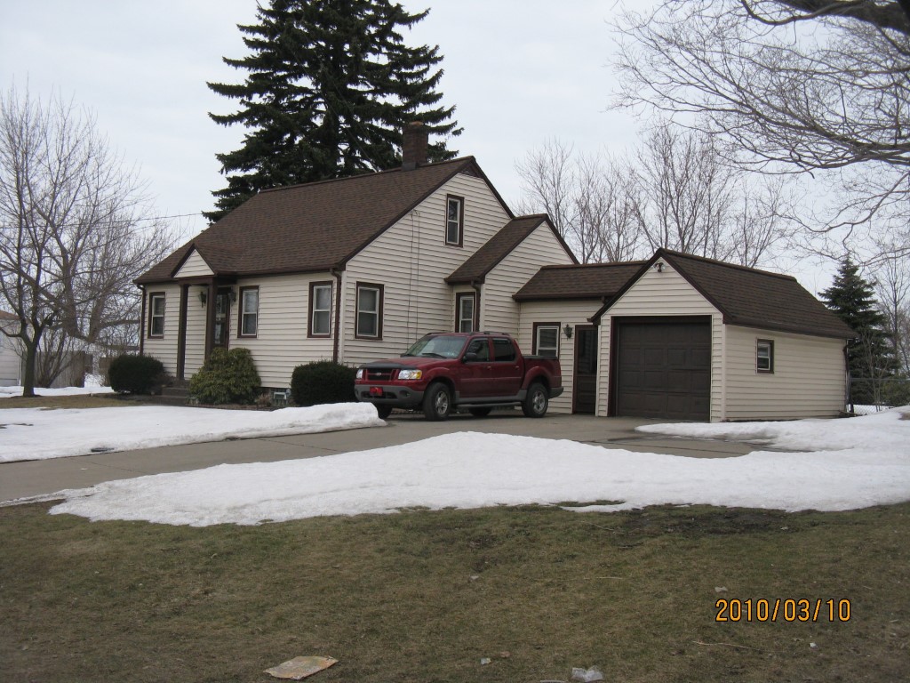
Address: 4727 WATTSBURG RD
Parcel: 33106477005300
Parcel Profile
Address
4727 | WATTSBURG | RD
Street Status
PAVED
School District
MILLCREEK SCHOOL
Acreage
0.5383
Classification
R
Land Use Code
SINGLE FAMILY
Legal Description
4727 WATTSBURG RD 100 X 230.35
Square Feet
799
Topo
ABOVE STREET
Utility
ALL PUBLIC
Zoning
Please contact your municipal zoning officer
Deed Book
1415
Deed Page
0503
2026 Tax Values
Land Value / Taxable
23,000 / 23,000.00
Building Value / Taxable
44,910 / 44,910.00
Total Value / Taxable
67,910 / 67,910.00
Clean & Green
Inactive
Homestead Status
Active
Farmstead Status
Inactive
Lerta Amount
0
Lerta Expiration Year
0
Residential Data
Card 1
Style
BUNGALOW
Basement
PART
Year Built
1939
Exterior Wall
ALUMINUM/VINYL
Total Living Area
799
Full Baths
1
Half Baths
0
Fuel Type
GAS
Heating
CENTRAL
Heating System
FORCED AIR
Stories
1.0
Total Bedrooms
2
Total Family Rooms
0
Total Rooms
5
Fireplaces
0
Other Buildings & Yards
Description
Built
Width
Length
Area
FRAME UTILITY SHED
1990
10
8
80
Sales History
Sale Date
Type
Price
Book / Page
Other Info
3/27/1981
0
1415 / 0503
Parcel Sketches
Residential Card 1
A
MAIN
799 square feet
B
ST_PT STONE OR TILE PATIO
90 square feet
C
FR GR FRAME GARAGE
200 square feet
D
EFP ENCL FRAME PORCH
90 square feet
E
OFP OPEN FRAME PORCH
12 square feet
Parcel Images
Please note:
this tab is for informational purposes only and may not show all delinquencies, see the Taxes tab for more accurate delinquent taxes due.