Elected Officials
Courts
Departments
Initiatives
Open Government
About
Login / Register
Home
/
Property & Tax Records
/
Property Records
/
Property & Tax Search
/
Parcel Profile
/
Print View
Search for Another Parcel
Parcel Profile
Historical Card
Sketches
Photos
Tax Map
Taxes
Print View
Print This Page
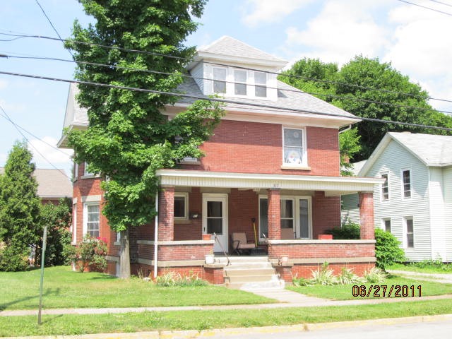
Address: 67 S PEARL ST
Parcel: 35006047001499
Parcel Profile
Address
67 | S | PEARL | ST
Street Status
PAVED | SIDEWALK
School District
NORTH EAST SCHOOL
Acreage
0.1910
Classification
C
Land Use Code
NON-PROFIT ORG-ELKS,KNIGHTS OF COLUM ETC
Legal Description
67 SO PEARL ST(PRSNG) 52 X 160
Square Feet
4116
Topo
LEVEL
Utility
ALL PUBLIC
Zoning
Please contact your municipal zoning officer
Deed Book
1072
Deed Page
0316
2026 Tax Values
Land Value / Taxable
16,600 / 16,600.00
Building Value / Taxable
86,900 / 86,900.00
Total Value / Taxable
103,500 / 103,500.00
Clean & Green
Inactive
Homestead Status
Inactive
Farmstead Status
Inactive
Lerta Amount
0
Lerta Expiration Year
0
Commercial Data
Card 1
RESIDENTIAL 1 FAMILY
Business Living Area - 4116
Year Built - 1900
Improvement Name - GROUP HOME
Value - 82670
Other Buildings & Yards
No OBY Data Found
Sales History
Sale Date
Type
Price
Book / Page
Other Info
7/3/1972
0
1072 / 0316
9/23/1958
0
0785 / 0121
Parcel Sketches
Commercial Card 1
A
MAIN
1372 square feet
B
MAIN
1372 square feet
C
MAIN
1372 square feet
D
MAIN
664 square feet
Parcel Images
Please note:
this tab is for informational purposes only and may not show all delinquencies, see the Taxes tab for more accurate delinquent taxes due.