Elected Officials
Courts
Departments
Initiatives
Open Government
About
Login / Register
Home
/
Property & Tax Records
/
Property Records
/
Property & Tax Search
/
Parcel Profile
/
Print View
Search for Another Parcel
Parcel Profile
Historical Card
Sketches
Photos
Tax Map
Taxes
Print View
Print This Page
Address: 101 CLAY ST
Parcel: 36010038000800
Parcel Profile
Address
101 | CLAY | ST
Street Status
PAVED
School District
NORTH EAST SCHOOL
Acreage
0.7692
Classification
E
Land Use Code
EXEMPT LOCAL GOVERNMENT (TWP & BORO)
Legal Description
101 CLAY ST 158.2X220.4 IRR
Square Feet
9308
Topo
LEVEL
Utility
ALL PUBLIC
Zoning
Please contact your municipal zoning officer
Deed Book
0391
Deed Page
0053
2026 Tax Values
Land Value / Taxable
60,300 / 60,300.00
Building Value / Taxable
127,800 / 127,800.00
Total Value / Taxable
188,100 / 188,100.00
Clean & Green
Inactive
Homestead Status
Inactive
Farmstead Status
Inactive
Lerta Amount
0
Lerta Expiration Year
0
Commercial Data
Card 1
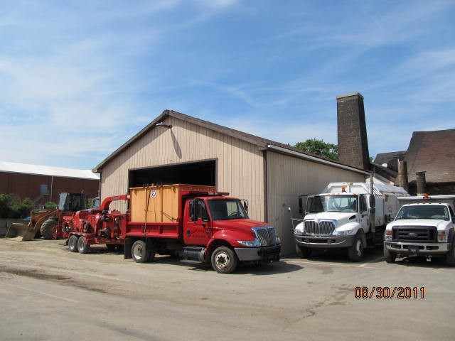
AUTO SERVICE GARAGE
Business Living Area - 3360
Year Built - 1991
Improvement Name - NE DEPT OF STREETS
Value - 33570
Card 2
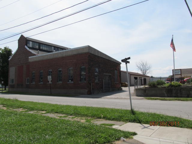
WAREHOUSE
Business Living Area - 5948
Year Built - 1900
Improvement Name - NE DEPT OF STREETS
Value - 79760
Other Buildings & Yards
No OBY Data Found
Sales History
Sale Date
Type
Price
Book / Page
Other Info
1/1/1969
0
0391 / 0053
Parcel Sketches
Commercial Card 1
A
MAIN
3360 square feet
Commercial Card 2
A
MAIN
4148 square feet
B
MAIN
1800 square feet
Parcel Images
Please note:
this tab is for informational purposes only and may not show all delinquencies, see the Taxes tab for more accurate delinquent taxes due.