Elected Officials
Courts
Departments
Initiatives
Open Government
About
Login / Register
Home
/
Property & Tax Records
/
Property Records
/
Property & Tax Search
/
Parcel Profile
/
Print View
Search for Another Parcel
Parcel Profile
Historical Card
Sketches
Photos
Tax Map
Taxes
Print View
Print This Page
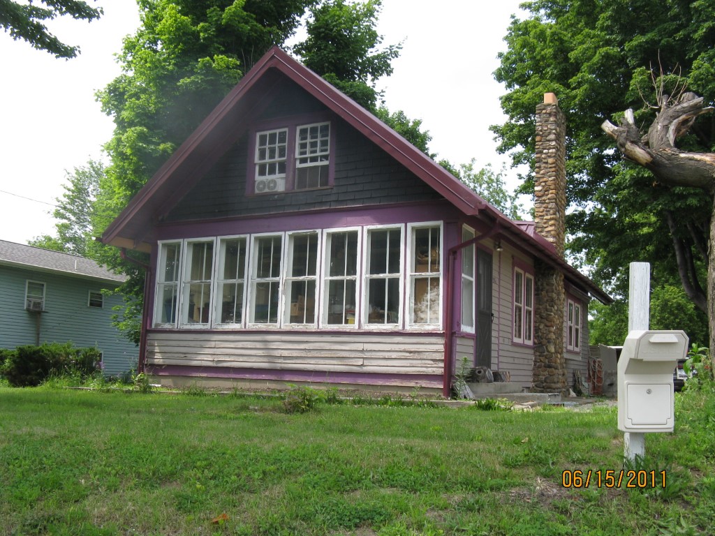
Address: 2951 HILLCREST AVE
Parcel: 37037056000900
Parcel Profile
Address
2951 | HILLCREST | AVE
Street Status
PAVED
School District
NORTH EAST SCHOOL
Acreage
0.3085
Classification
R
Land Use Code
SINGLE FAMILY
Legal Description
2951 HILLCREST AVE 123.25X159
Square Feet
620
Topo
LEVEL
Utility
PUBLIC WATER | GAS | SEPTIC
Zoning
Please contact your municipal zoning officer
Deed Book
1251
Deed Page
0058
2026 Tax Values
Land Value / Taxable
31,200 / 31,200.00
Building Value / Taxable
7,100 / 7,100.00
Total Value / Taxable
38,300 / 38,300.00
Clean & Green
Inactive
Homestead Status
Active
Farmstead Status
Inactive
Lerta Amount
0
Lerta Expiration Year
0
Residential Data
Card 1
Style
BUNGALOW
Basement
FULL
Year Built
1920
Exterior Wall
FRAME
Total Living Area
620
Full Baths
1
Half Baths
0
Fuel Type
GAS
Heating
NONE
Heating System
NONE
Stories
1.0
Total Bedrooms
1
Total Family Rooms
0
Total Rooms
5
Fireplaces
0
Other Buildings & Yards
Description
Built
Width
Length
Area
FRAME OR CB DETACHED GARAGE
1935
24
18
432
Sales History
Sale Date
Type
Price
Book / Page
Other Info
1/19/1977
0
1251 / 0058
Parcel Sketches
Residential Card 1
A
MAIN
620 square feet
B
EFP ENCL FRAME PORCH
160 square feet
Parcel Images
Please note:
this tab is for informational purposes only and may not show all delinquencies, see the Taxes tab for more accurate delinquent taxes due.