Elected Officials
Courts
Departments
Initiatives
Open Government
About
Login / Register
Home
/
Property & Tax Records
/
Property Records
/
Property & Tax Search
/
Parcel Profile
/
Print View
Search for Another Parcel
Parcel Profile
Historical Card
Sketches
Photos
Tax Map
Taxes
Print View
Print This Page
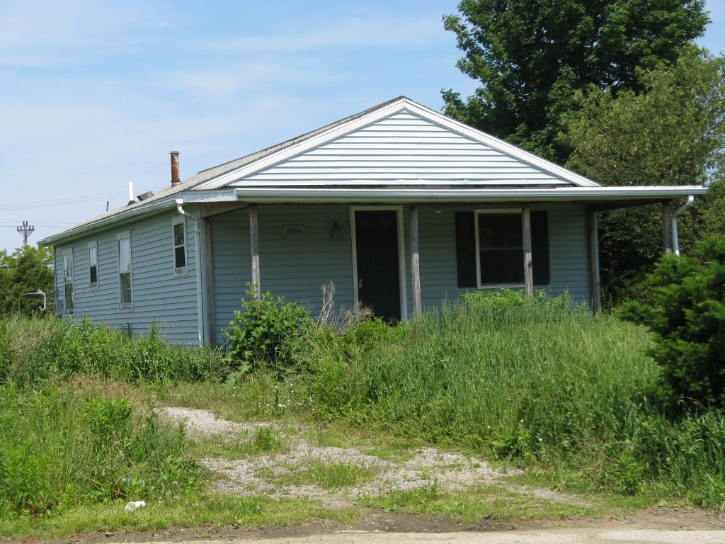
Address: 11157 ALDER CT
Parcel: 37041088000300
Parcel Profile
Address
11157 | ALDER | CT
Street Status
PAVED
School District
NORTH EAST SCHOOL
Acreage
0.2127
Classification
R
Land Use Code
SINGLE FAMILY
Legal Description
11157 ALDER CT 111.35 X IRR
Square Feet
960
Topo
LEVEL
Utility
ALL PUBLIC
Zoning
Please contact your municipal zoning officer
Deed Book
2017
Deed Page
025493
2026 Tax Values
Land Value / Taxable
28,700 / 28,700.00
Building Value / Taxable
35,040 / 35,040.00
Total Value / Taxable
63,740 / 63,740.00
Clean & Green
Inactive
Homestead Status
Active
Farmstead Status
Inactive
Lerta Amount
0
Lerta Expiration Year
0
Residential Data
Card 1
Style
BUNGALOW
Basement
FULL
Year Built
1935
Exterior Wall
ALUMINUM/VINYL
Total Living Area
960
Full Baths
1
Half Baths
0
Fuel Type
GAS
Heating
CENTRAL
Heating System
FORCED AIR
Stories
1.0
Total Bedrooms
3
Total Family Rooms
0
Total Rooms
5
Fireplaces
0
Other Buildings & Yards
No OBY Data Found
Sales History
Sale Date
Type
Price
Book / Page
Other Info
11/20/2017
LAND & BUILDING
110000
2017 / 025493
SPECIAL WARRANTY DEED
3/5/2013
LAND & BUILDING
92000
2013 / 005108
DEED
12/13/2012
LAND & BUILDING
28815
2012 / 033967
QUIT CLAIM DEED
10/25/2012
LAND & BUILDING
0
2012 / 029283
MARSHALLS DEED
9/9/2005
LAND & BUILDING
98500
1268 / 1195
DEED
9/8/2000
LAND & BUILDING
63000
725 / 1131
Parcel Sketches
Residential Card 1
A
MAIN
960 square feet
B
EFP ENCL FRAME PORCH
192 square feet
Parcel Images
Please note:
this tab is for informational purposes only and may not show all delinquencies, see the Taxes tab for more accurate delinquent taxes due.