Elected Officials
Courts
Departments
Initiatives
Open Government
About
Login / Register
Home
/
Property & Tax Records
/
Property Records
/
Property & Tax Search
/
Parcel Profile
/
Print View
Search for Another Parcel
Parcel Profile
Historical Card
Sketches
Photos
Tax Map
Taxes
Print View
Print This Page
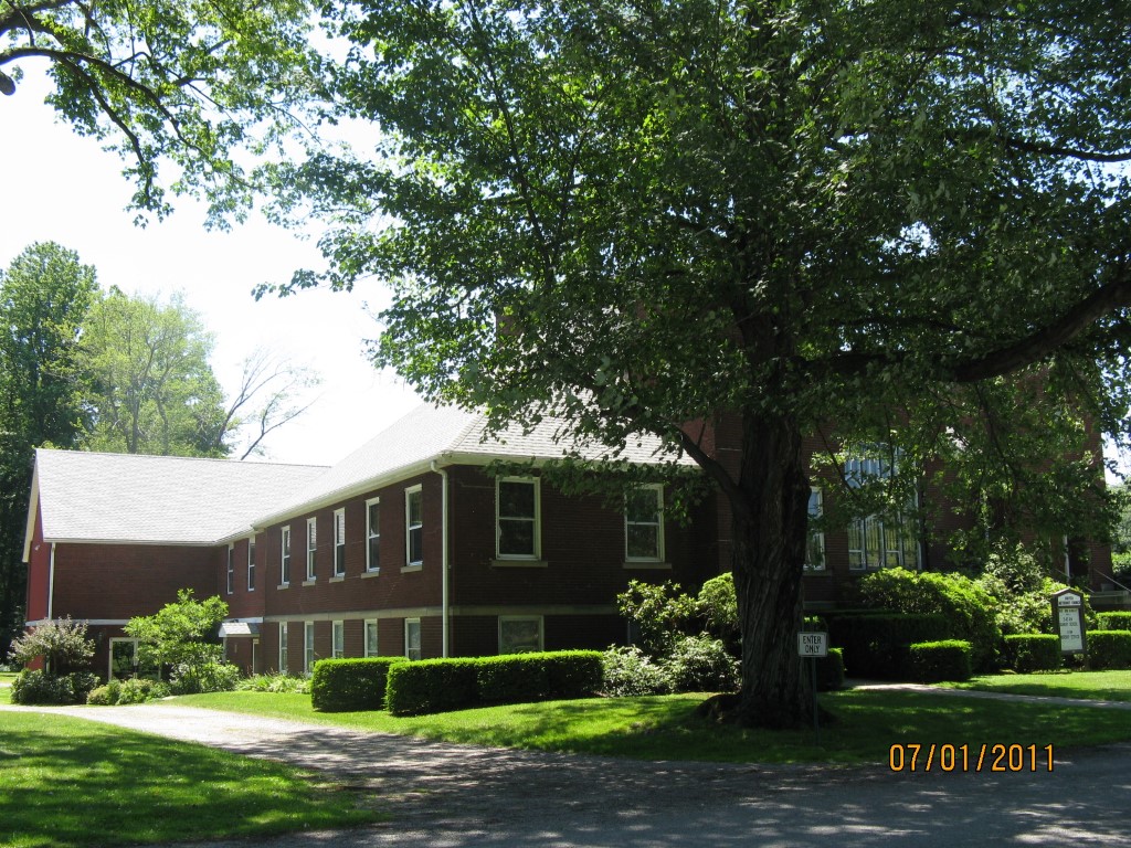
Address: 13790 CHESTNUT ST
Parcel: 39015042001000
Parcel Profile
Address
13790 | CHESTNUT | ST
Street Status
PAVED
School District
NORTHWESTERN SCHOOL
Acreage
1.0000
Classification
E
Land Use Code
EXEMPT CHURCHES
Legal Description
13790 CHESTNUT ST 148.66 X 346.7
Square Feet
10524
Topo
LEVEL
Utility
ALL PUBLIC
Zoning
Please contact your municipal zoning officer
Deed Book
2023
Deed Page
014904
2026 Tax Values
Land Value / Taxable
22,500 / 22,500.00
Building Value / Taxable
861,200 / 861,200.00
Total Value / Taxable
883,700 / 883,700.00
Clean & Green
Inactive
Homestead Status
Inactive
Farmstead Status
Inactive
Lerta Amount
0
Lerta Expiration Year
0
Commercial Data
Card 1
RELIGIOUS
Business Living Area - 10524
Year Built - 1915
Improvement Name - UNITED METHODIST CHURCH
Value - 925980
Other Buildings & Yards
No OBY Data Found
Sales History
Sale Date
Type
Price
Book / Page
Other Info
9/6/2023
LAND & BUILDING
0
2023 / 014904
QUIT CLAIM DEED
1/8/1999
0
0611 / 0566
Parcel Sketches
Commercial Card 1
A
MAIN
3918 square feet
B
MAIN
3918 square feet
C
MAIN
3826 square feet
D
MAIN
340 square feet
E
MAIN
2440 square feet
Parcel Images
Please note:
this tab is for informational purposes only and may not show all delinquencies, see the Taxes tab for more accurate delinquent taxes due.