Elected Officials
Courts
Departments
Initiatives
Open Government
About
Login / Register
Home
/
Property & Tax Records
/
Property Records
/
Property & Tax Search
/
Parcel Profile
/
Print View
Search for Another Parcel
Parcel Profile
Historical Card
Sketches
Photos
Tax Map
Taxes
Print View
Print This Page
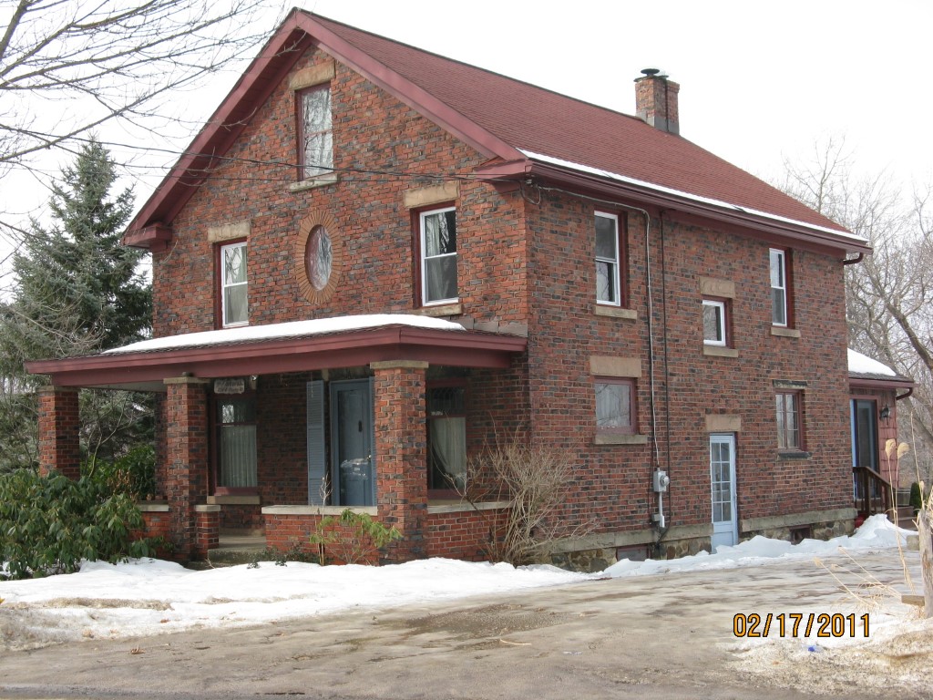
Address: 2560 HERSHEY RD
Parcel: 40001009001700
Parcel Profile
Address
2560 | HERSHEY | RD
Street Status
PAVED
School District
FORT LEBOEUF SCHOOL
Acreage
1.1000
Classification
R
Land Use Code
SINGLE FAMILY
Legal Description
2560 HERSHEY RD 1.1 AC
Square Feet
1848
Topo
ROLLING
Utility
GAS | WELL | SEPTIC
Zoning
Please contact your municipal zoning officer
Deed Book
2013
Deed Page
011254
2026 Tax Values
Land Value / Taxable
35,800 / 35,800.00
Building Value / Taxable
73,470 / 73,470.00
Total Value / Taxable
109,270 / 109,270.00
Clean & Green
Inactive
Homestead Status
Active
Farmstead Status
Inactive
Lerta Amount
0
Lerta Expiration Year
0
Residential Data
Card 1
Style
OLD STYLE
Basement
FULL
Year Built
1920
Exterior Wall
BRICK
Total Living Area
1848
Full Baths
1
Half Baths
0
Fuel Type
GAS
Heating
CENTRAL
Heating System
FORCED AIR
Stories
2.0
Total Bedrooms
4
Total Family Rooms
0
Total Rooms
9
Fireplaces
0
Other Buildings & Yards
Description
Built
Width
Length
Area
BANK BARN
1900
50
42
2100
Sales History
Sale Date
Type
Price
Book / Page
Other Info
5/7/2013
LAND & BUILDING
0
2013 / 011254
DEED
7/27/2005
LAND & BUILDING
134000
1255 / 0671
WARRANTY/SURVIVORSHIP DEED
5/16/1960
0
0822 / 0023
Parcel Sketches
Residential Card 1
A
MAIN
864 square feet
B
OMP OPEN MASONRY PORCH
175 square feet
C
1S FR ONE STORY FRAME
120 square feet
Parcel Images
Please note:
this tab is for informational purposes only and may not show all delinquencies, see the Taxes tab for more accurate delinquent taxes due.