Elected Officials
Courts
Departments
Initiatives
Open Government
About
Login / Register
Home
/
Property & Tax Records
/
Property Records
/
Property & Tax Search
/
Parcel Profile
/
Print View
Search for Another Parcel
Parcel Profile
Historical Card
Sketches
Photos
Tax Map
Taxes
Print View
Print This Page
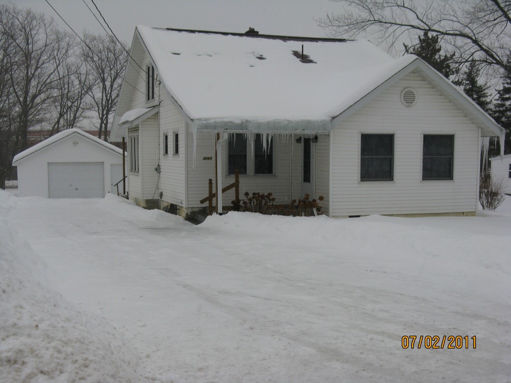
Address: 2065 OLD HERSHEY RD
Parcel: 40004016100300
Parcel Profile
Address
2065 | OLD HERSHEY | RD
Street Status
PAVED
School District
FORT LEBOEUF SCHOOL
Acreage
0.6831
Classification
R
Land Use Code
SINGLE FAMILY
Legal Description
2065 OLD HERSHEY RD 100 X 195 IRREG
Square Feet
1349
Topo
LEVEL
Utility
GAS | WELL | SEPTIC
Zoning
Please contact your municipal zoning officer
Deed Book
2014
Deed Page
014365
2026 Tax Values
Land Value / Taxable
43,800 / 43,800.00
Building Value / Taxable
45,800 / 45,800.00
Total Value / Taxable
89,600 / 89,600.00
Clean & Green
Inactive
Homestead Status
Inactive
Farmstead Status
Inactive
Lerta Amount
0
Lerta Expiration Year
0
Residential Data
Card 1
Style
CAPE
Basement
FULL
Year Built
1920
Exterior Wall
ALUMINUM/VINYL
Total Living Area
1349
Full Baths
1
Half Baths
1
Fuel Type
GAS
Heating
CENTRAL
Heating System
FORCED AIR
Stories
1.0
Total Bedrooms
2
Total Family Rooms
0
Total Rooms
5
Fireplaces
0
Other Buildings & Yards
Description
Built
Width
Length
Area
FRAME OR CB DETACHED GARAGE
1920
20
32
640
Sales History
Sale Date
Type
Price
Book / Page
Other Info
7/15/2014
LAND & BUILDING
65000
2014 / 014365
DEED
8/24/1955
0
0711 / 0249
Parcel Sketches
Residential Card 1
A
MAIN
952 square feet
B
FRBAY FRAME BAY
16 square feet
C
EFP ENCL FRAME PORCH
60 square feet
D
FR UT FRAME UTILITY BUILDING
20 square feet
E
EFP ENCL FRAME PORCH
144 square feet
F
MA_PT CONC/MAS PATIO
54 square feet
Parcel Images
Please note:
this tab is for informational purposes only and may not show all delinquencies, see the Taxes tab for more accurate delinquent taxes due.