Elected Officials
Courts
Departments
Initiatives
Open Government
About
Login / Register
Home
/
Property & Tax Records
/
Property Records
/
Property & Tax Search
/
Parcel Profile
/
Print View
Search for Another Parcel
Parcel Profile
Historical Card
Sketches
Photos
Tax Map
Taxes
Print View
Print This Page
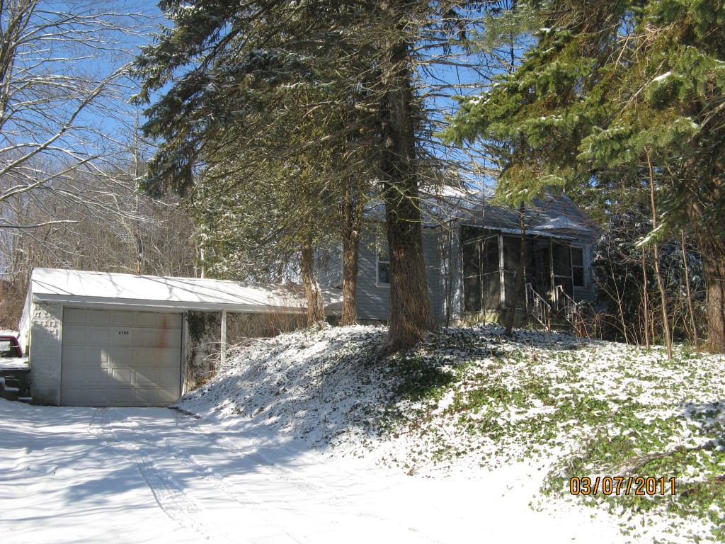
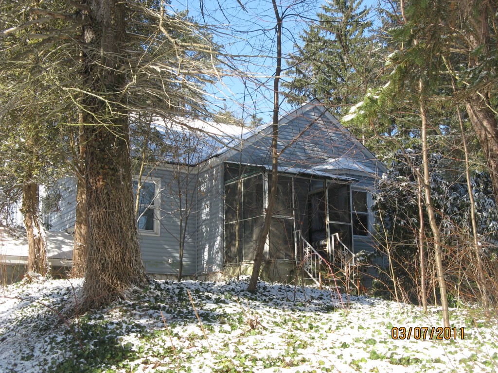
Address: 8500 PERRY HWY
Parcel: 40014086004500
Parcel Profile
Address
8500 | PERRY | HWY
Street Status
PAVED
School District
FORT LEBOEUF SCHOOL
Acreage
3.9000
Classification
R
Land Use Code
SINGLE FAMILY
Legal Description
8500 PERRY HWY 3.9 AC
Square Feet
1304
Topo
LEVEL
Utility
ALL PUBLIC
Zoning
Please contact your municipal zoning officer
Deed Book
2014
Deed Page
015924
2026 Tax Values
Land Value / Taxable
45,700 / 45,700.00
Building Value / Taxable
53,110 / 53,110.00
Total Value / Taxable
98,810 / 98,810.00
Clean & Green
Inactive
Homestead Status
Active
Farmstead Status
Inactive
Lerta Amount
0
Lerta Expiration Year
0
Residential Data
Card 1
Style
CAPE
Basement
FULL
Year Built
1938
Exterior Wall
ALUMINUM/VINYL
Total Living Area
1304
Full Baths
1
Half Baths
0
Fuel Type
GAS
Heating
CENTRAL
Heating System
FORCED AIR
Stories
1.0
Total Bedrooms
2
Total Family Rooms
0
Total Rooms
4
Fireplaces
0
Other Buildings & Yards
No OBY Data Found
Sales History
Sale Date
Type
Price
Book / Page
Other Info
8/1/2014
LAND & BUILDING
71000
2014 / 015924
FIDUCIARY DEED
6/5/1979
0
1351 / 0142
Parcel Sketches
Residential Card 1
A
MAIN
920 square feet
B
FR GR FRAME GARAGE
728 square feet
C
FRBAY FRAME BAY
16 square feet
D
MA STOOP/TERR MAS STOOP
60 square feet
Parcel Images
Please note:
this tab is for informational purposes only and may not show all delinquencies, see the Taxes tab for more accurate delinquent taxes due.