Elected Officials
Courts
Departments
Initiatives
Open Government
About
Login / Register
Home
/
Property & Tax Records
/
Property Records
/
Property & Tax Search
/
Parcel Profile
/
Print View
Search for Another Parcel
Parcel Profile
Historical Card
Sketches
Photos
Tax Map
Taxes
Print View
Print This Page
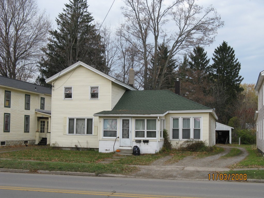
Address: 35 E HIGH ST
Parcel: 41006013002000
Parcel Profile
Address
35 | E | HIGH | ST
Street Status
PAVED | SIDEWALK
School District
UNION CITY AREA SCHOOL
Acreage
0.3091
Classification
R
Land Use Code
TWO FAMILY
Legal Description
35 E HIGH ST 50.5X264
Square Feet
1912
Topo
LEVEL
Utility
ALL PUBLIC
Zoning
Please contact your municipal zoning officer
Deed Book
2018
Deed Page
026426
2026 Tax Values
Land Value / Taxable
11,400 / 11,400.00
Building Value / Taxable
62,120 / 62,120.00
Total Value / Taxable
73,520 / 73,520.00
Clean & Green
Inactive
Homestead Status
Inactive
Farmstead Status
Inactive
Lerta Amount
0
Lerta Expiration Year
0
Residential Data
Card 1
Style
OLD STYLE
Basement
PART
Year Built
1900
Exterior Wall
ALUMINUM/VINYL
Total Living Area
1912
Full Baths
2
Half Baths
0
Fuel Type
GAS
Heating
CENTRAL
Heating System
FORCED AIR
Stories
2.0
Total Bedrooms
4
Total Family Rooms
0
Total Rooms
7
Fireplaces
0
Other Buildings & Yards
Description
Built
Width
Length
Area
DETACHED METAL GARAGE
1900
24
32
768
FRAME UTILITY SHED
1950
10
10
100
Sales History
Sale Date
Type
Price
Book / Page
Other Info
12/24/2018
LAND & BUILDING
10000
2018 / 026426
WARRANTY/SURVIVORSHIP DEED
4/20/1995
0
0380 / 0430
Parcel Sketches
Residential Card 1
A
MAIN
416 square feet
B
OFP OPEN FRAME PORCH
288 square feet
C
OFP OPEN FRAME PORCH
126 square feet
D
UNFIN BSMT BASEMENT UNFINISHED 1S FR ONE STORY FRAME
1080 square feet
E
OFP OPEN FRAME PORCH
112 square feet
Parcel Images
Please note:
this tab is for informational purposes only and may not show all delinquencies, see the Taxes tab for more accurate delinquent taxes due.