Elected Officials
Courts
Departments
Initiatives
Open Government
About
Login / Register
Home
/
Property & Tax Records
/
Property Records
/
Property & Tax Search
/
Parcel Profile
/
Print View
Search for Another Parcel
Parcel Profile
Historical Card
Sketches
Photos
Tax Map
Taxes
Print View
Print This Page
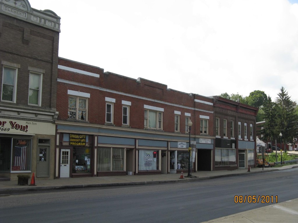
Address: 17 N MAIN ST
Parcel: 41010038000200
Parcel Profile
Address
17 | N | MAIN | ST
Street Status
PAVED | SIDEWALK
School District
UNION CITY AREA SCHOOL
Acreage
0.2806
Classification
C
Land Use Code
RESTAURANTS, STORES (RETAIL)
Legal Description
17 N MAIN ST 106 X 108 IRR
Square Feet
25502
Topo
LEVEL
Utility
ALL PUBLIC
Zoning
Please contact your municipal zoning officer
Deed Book
2021
Deed Page
024203
2026 Tax Values
Land Value / Taxable
18,300 / 18,300.00
Building Value / Taxable
248,700 / 248,700.00
Total Value / Taxable
267,000 / 267,000.00
Clean & Green
Inactive
Homestead Status
Inactive
Farmstead Status
Inactive
Lerta Amount
0
Lerta Expiration Year
0
Commercial Data
Card 1
DOWNTOWN ROW TYPE
Business Living Area - 25502
Year Built - 1900
Improvement Name - ERIE CO WIC J & K JEWELRY
Value - 330430
Other Buildings & Yards
Description
Built
Width
Length
Area
PAVING ASPHALT PARKING
1960
0
0
1200
Sales History
Sale Date
Type
Price
Book / Page
Other Info
9/9/2021
LAND & BUILDING
475000
2021 / 024203
SPECIAL WARRANTY DEED
2/20/1985
0
1569 / 0223
Parcel Sketches
Commercial Card 1
A
MAIN
9204 square feet
B
MAIN
4316 square feet
C
MAIN
4862 square feet
D
MAIN
9204 square feet
E
MAIN
3160 square feet
F
MAIN
3160 square feet
G
MAIN
3160 square feet
H
MAIN
800 square feet
Parcel Images
Please note:
this tab is for informational purposes only and may not show all delinquencies, see the Taxes tab for more accurate delinquent taxes due.