Elected Officials
Courts
Departments
Initiatives
Open Government
About
Login / Register
Home
/
Property & Tax Records
/
Property Records
/
Property & Tax Search
/
Parcel Profile
/
Print View
Search for Another Parcel
Parcel Profile
Historical Card
Sketches
Photos
Tax Map
Taxes
Print View
Print This Page
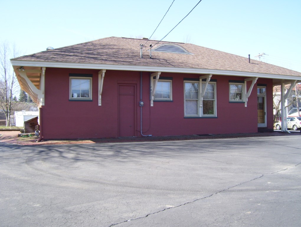
Address: 2 E HIGH STREET
Parcel: 41010040000100
Parcel Profile
Address
2 | E | HIGH | STREET
Street Status
PAVED
School District
UNION CITY AREA SCHOOL
Acreage
0.3693
Classification
C
Land Use Code
OFFICE BLDGS/LABS/LIBRARIES
Legal Description
RAILWAY 218 X 123 X 152 TRI
Square Feet
2928
Topo
LEVEL
Utility
ALL PUBLIC
Zoning
Please contact your municipal zoning officer
Deed Book
2020
Deed Page
021048
2026 Tax Values
Land Value / Taxable
16,100 / 16,100.00
Building Value / Taxable
88,800 / 88,800.00
Total Value / Taxable
104,900 / 104,900.00
Clean & Green
Inactive
Homestead Status
Inactive
Farmstead Status
Inactive
Lerta Amount
0
Lerta Expiration Year
0
Commercial Data
Card 1
RAIL/BUS/AIR TERMINAL
Business Living Area - 2928
Year Built - 1900
Improvement Name - RON JONES HARDWOOD
Value - 83240
Other Buildings & Yards
No OBY Data Found
Sales History
Sale Date
Type
Price
Book / Page
Other Info
10/9/2020
LAND & BUILDING
158427
2020 / 021048
SPECIAL WARRANTY DEED
10/16/2018
LAND & BUILDING
0
2018 / 021372
QUIT CLAIM DEED
11/10/1988
0
0070 / 0815
Parcel Sketches
Commercial Card 1
A
MAIN
1464 square feet
B
MAIN
1464 square feet
Parcel Images
Please note:
this tab is for informational purposes only and may not show all delinquencies, see the Taxes tab for more accurate delinquent taxes due.