Elected Officials
Courts
Departments
Initiatives
Open Government
About
Login / Register
Home
/
Property & Tax Records
/
Property Records
/
Property & Tax Search
/
Parcel Profile
/
Print View
Search for Another Parcel
Parcel Profile
Historical Card
Sketches
Photos
Tax Map
Taxes
Print View
Print This Page
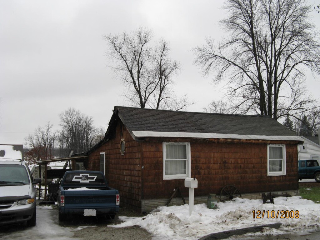
Address: 34 GILLETTE ST
Parcel: 41014059000700
Parcel Profile
Address
34 | GILLETTE | ST
Street Status
UNPAVED
School District
UNION CITY AREA SCHOOL
Acreage
0.1573
Classification
R
Land Use Code
SINGLE FAMILY
Legal Description
34 GILLETTE ST 50X137 IRR
Square Feet
960
Topo
LEVEL
Utility
PUBLIC WATER | GAS | SEPTIC
Zoning
Please contact your municipal zoning officer
Deed Book
0052
Deed Page
1770
2026 Tax Values
Land Value / Taxable
9,700 / 9,700.00
Building Value / Taxable
25,400 / 25,400.00
Total Value / Taxable
35,100 / 35,100.00
Clean & Green
Inactive
Homestead Status
Inactive
Farmstead Status
Inactive
Lerta Amount
0
Lerta Expiration Year
0
Residential Data
Card 1
Style
BUNGALOW
Basement
NONE
Year Built
1920
Exterior Wall
COMPOSITION
Total Living Area
960
Full Baths
1
Half Baths
0
Fuel Type
PROPANE
Heating
CENTRAL
Heating System
FORCED AIR
Stories
1.0
Total Bedrooms
3
Total Family Rooms
0
Total Rooms
5
Fireplaces
0
Other Buildings & Yards
Description
Built
Width
Length
Area
FRAME UTILITY SHED
2021
10
12
120
Sales History
Sale Date
Type
Price
Book / Page
Other Info
6/7/1988
0
0052 / 1770
Parcel Sketches
Residential Card 1
A
MAIN
960 square feet
Parcel Images
Please note:
this tab is for informational purposes only and may not show all delinquencies, see the Taxes tab for more accurate delinquent taxes due.