Elected Officials
Courts
Departments
Initiatives
Open Government
About
Login / Register
Home
/
Property & Tax Records
/
Property Records
/
Property & Tax Search
/
Parcel Profile
/
Print View
Search for Another Parcel
Parcel Profile
Historical Card
Sketches
Photos
Tax Map
Taxes
Print View
Print This Page
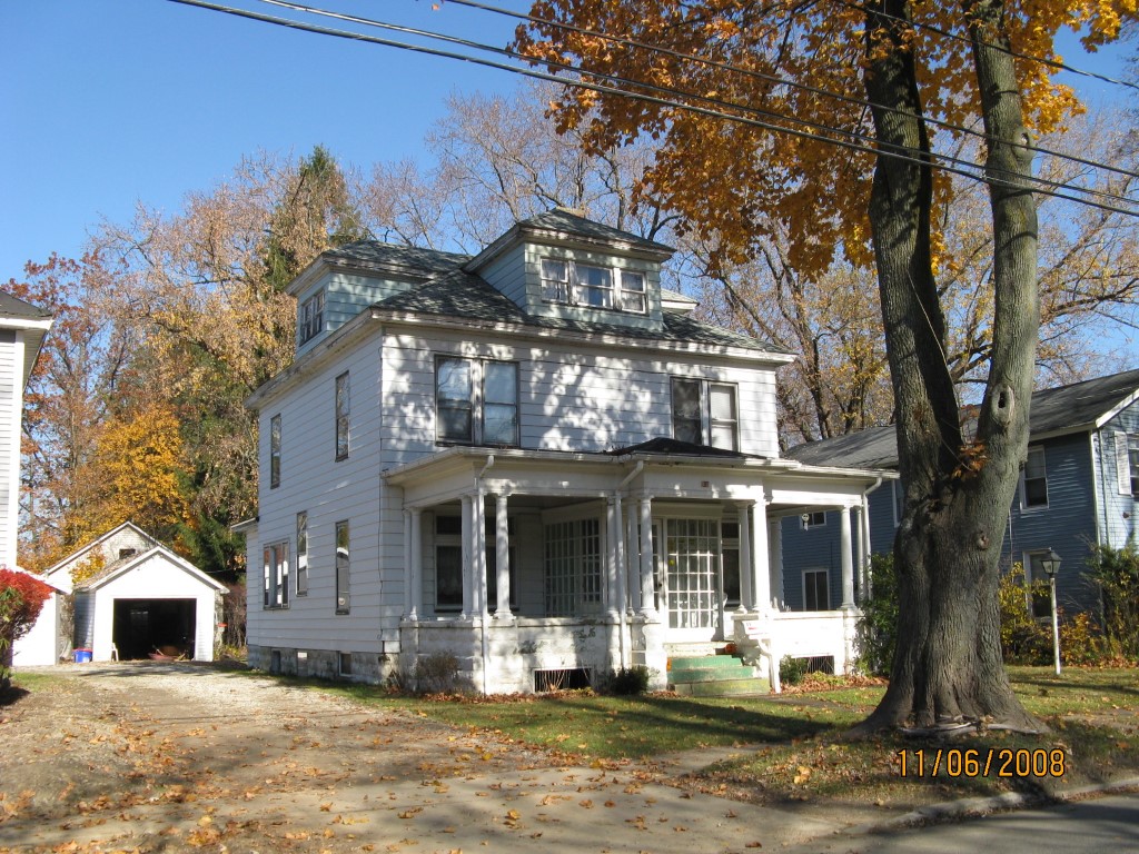
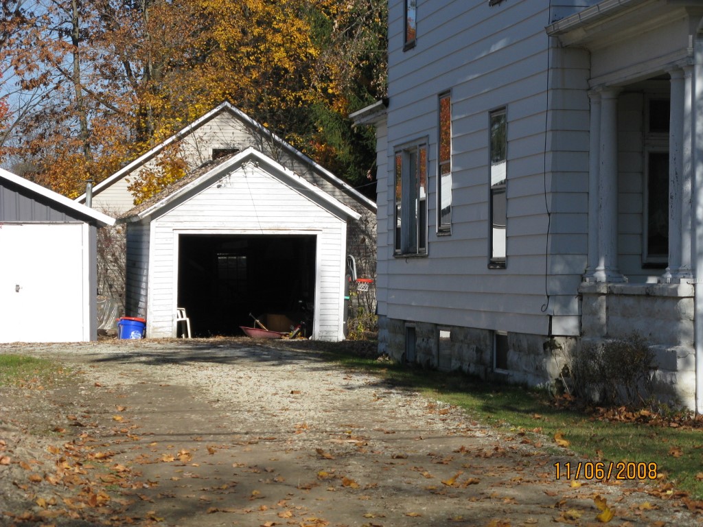
Address: 69 W HIGH ST
Parcel: 42007017000800
Parcel Profile
Address
69 | W | HIGH | ST
Street Status
PAVED | SIDEWALK
School District
UNION CITY AREA SCHOOL
Acreage
0.0620
Classification
R
Land Use Code
SINGLE FAMILY
Legal Description
69 W HIGH ST 54X150
Square Feet
1768
Topo
LEVEL
Utility
ALL PUBLIC
Zoning
Please contact your municipal zoning officer
Deed Book
0742
Deed Page
0490
2026 Tax Values
Land Value / Taxable
10,500 / 10,500.00
Building Value / Taxable
60,900 / 60,900.00
Total Value / Taxable
71,400 / 71,400.00
Clean & Green
Inactive
Homestead Status
Active
Farmstead Status
Inactive
Lerta Amount
0
Lerta Expiration Year
0
Residential Data
Card 1
Style
OLD STYLE
Basement
FULL
Year Built
1913
Exterior Wall
ALUMINUM/VINYL
Total Living Area
1768
Full Baths
1
Half Baths
1
Fuel Type
GAS
Heating
CENTRAL
Heating System
FORCED AIR
Stories
2.0
Total Bedrooms
4
Total Family Rooms
0
Total Rooms
8
Fireplaces
0
Other Buildings & Yards
No OBY Data Found
Sales History
Sale Date
Type
Price
Book / Page
Other Info
12/8/2000
LAND & BUILDING
45000
0742 / 0490
Parcel Sketches
Residential Card 1
A
MAIN
784 square feet
B
OFP OPEN FRAME PORCH
204 square feet
C
UNFIN BSMT BASEMENT UNFINISHED FR UT FRAME UTILITY BUILDING
88 square feet
D
UNFIN BSMT BASEMENT UNFINISHED 1S FR ONE STORY FRAME
128 square feet
E
UNFIN BSMT BASEMENT UNFINISHED 1S FR ONE STORY FRAME
72 square feet
F
OFP OPEN FRAME PORCH
60 square feet
G
EFP ENCL FRAME PORCH
56 square feet
Parcel Images
Please note:
this tab is for informational purposes only and may not show all delinquencies, see the Taxes tab for more accurate delinquent taxes due.