Elected Officials
Courts
Departments
Initiatives
Open Government
About
Login / Register
Home
/
Property & Tax Records
/
Property Records
/
Property & Tax Search
/
Parcel Profile
/
Print View
Search for Another Parcel
Parcel Profile
Historical Card
Sketches
Photos
Tax Map
Taxes
Print View
Print This Page
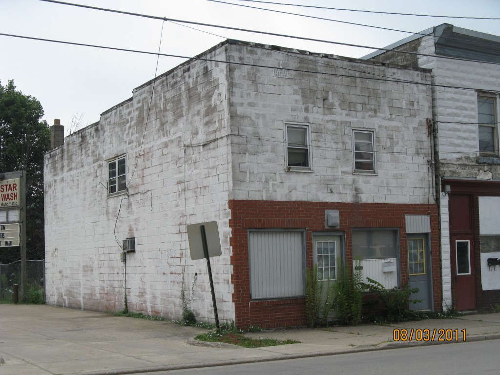
Address: 9 W HIGH ST
Parcel: 42007022000300
Parcel Profile
Address
9 | W | HIGH | ST
Street Status
PAVED | SIDEWALK
School District
UNION CITY AREA SCHOOL
Acreage
0.0413
Classification
C
Land Use Code
OFFICE BLDGS/LABS/LIBRARIES
Legal Description
9 W HIGH ST 20 X 98 IRR
Square Feet
1760
Topo
LEVEL
Utility
ALL PUBLIC
Zoning
Please contact your municipal zoning officer
Deed Book
2026
Deed Page
002365
2026 Tax Values
Land Value / Taxable
1,800 / 1,800.00
Building Value / Taxable
34,300 / 34,300.00
Total Value / Taxable
36,100 / 36,100.00
Clean & Green
Inactive
Homestead Status
Inactive
Farmstead Status
Inactive
Lerta Amount
0
Lerta Expiration Year
0
Commercial Data
Card 1
RETAIL SINGLE OCCUP
Business Living Area - 1760
Year Built - 1900
Improvement Name - NEWSPAPER DISTRIBUTION CTR
Value - 34340
Other Buildings & Yards
No OBY Data Found
Sales History
Sale Date
Type
Price
Book / Page
Other Info
2/13/2026
LAND & BUILDING
25000
2026 / 002365
SPECIAL WARRANTY DEED
11/6/2025
LAND & BUILDING
7000
2025 / 019880
DEED
11/6/2025
LAND & BUILDING
15000
2025 / 019881
QUIT CLAIM DEED
4/6/2018
LAND & BUILDING
22500
2018 / 006302
WARRANTY/SURVIVORSHIP DEED
3/26/2001
LAND & BUILDING
27500
760 / 2165
Parcel Sketches
Commercial Card 1
A
MAIN
880 square feet
B
MAIN
880 square feet
C
MAIN
880 square feet
Parcel Images
Please note:
this tab is for informational purposes only and may not show all delinquencies, see the Taxes tab for more accurate delinquent taxes due.