Elected Officials
Courts
Departments
Initiatives
Open Government
About
Login / Register
Home
/
Property & Tax Records
/
Property Records
/
Property & Tax Search
/
Parcel Profile
/
Print View
Search for Another Parcel
Parcel Profile
Historical Card
Sketches
Photos
Tax Map
Taxes
Print View
Print This Page
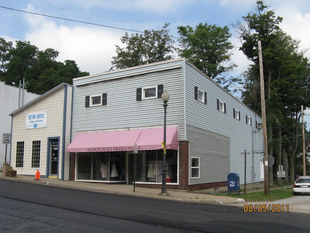
Address: 20 S MAIN ST
Parcel: 42010036000800
Parcel Profile
Address
20 | S | MAIN | ST
Street Status
PAVED | SIDEWALK
School District
UNION CITY AREA SCHOOL
Acreage
0.0482
Classification
C
Land Use Code
RESTAURANTS, STORES (RETAIL)
Legal Description
20 S MAIN ST 30X70
Square Feet
3886
Topo
LEVEL
Utility
ALL PUBLIC
Zoning
Please contact your municipal zoning officer
Deed Book
2021
Deed Page
009447
2026 Tax Values
Land Value / Taxable
3,200 / 3,200.00
Building Value / Taxable
52,700 / 52,700.00
Total Value / Taxable
55,900 / 55,900.00
Clean & Green
Inactive
Homestead Status
Inactive
Farmstead Status
Inactive
Lerta Amount
0
Lerta Expiration Year
0
Commercial Data
Card 1
RETAIL SINGLE OCCUP
Business Living Area - 3886
Year Built - 1945
Improvement Name - BRIDE'S PALACE
Value - 52690
Other Buildings & Yards
No OBY Data Found
Sales History
Sale Date
Type
Price
Book / Page
Other Info
4/19/2021
LAND & BUILDING
70000
2021 / 009447
SPECIAL WARRANTY DEED
1/15/1993
0
0249 / 1573
Parcel Sketches
Commercial Card 1
A
MAIN
1943 square feet
B
MAIN
1943 square feet
C
MAIN
1943 square feet
Parcel Images
Please note:
this tab is for informational purposes only and may not show all delinquencies, see the Taxes tab for more accurate delinquent taxes due.