Elected Officials
Courts
Departments
Initiatives
Open Government
About
Login / Register
Home
/
Property & Tax Records
/
Property Records
/
Property & Tax Search
/
Parcel Profile
/
Print View
Search for Another Parcel
Parcel Profile
Historical Card
Sketches
Photos
Tax Map
Taxes
Print View
Print This Page
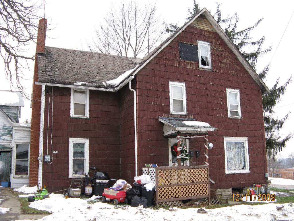
Address: 10 WA STATE HIGHWAY 49.5X83
Parcel: 42015078001400
Parcel Profile
Address
10 | WA STATE HIGHWAY 49.5X83
Street Status
PAVED
School District
UNION CITY AREA SCHOOL
Acreage
0.0943
Classification
R
Land Use Code
TWO FAMILY
Legal Description
10 WASHINGTON ST 49.5X83
Square Feet
1760
Topo
LEVEL
Utility
ALL PUBLIC
Zoning
Please contact your municipal zoning officer
Deed Book
0633
Deed Page
0987
2026 Tax Values
Land Value / Taxable
11,000 / 11,000.00
Building Value / Taxable
27,180 / 27,180.00
Total Value / Taxable
38,180 / 38,180.00
Clean & Green
Inactive
Homestead Status
Inactive
Farmstead Status
Inactive
Lerta Amount
0
Lerta Expiration Year
0
Residential Data
Card 1
Style
OLD STYLE
Basement
PART
Year Built
1910
Exterior Wall
COMPOSITION
Total Living Area
1760
Full Baths
2
Half Baths
0
Fuel Type
GAS
Heating
CENTRAL
Heating System
FORCED AIR
Stories
2.0
Total Bedrooms
2
Total Family Rooms
0
Total Rooms
5
Fireplaces
0
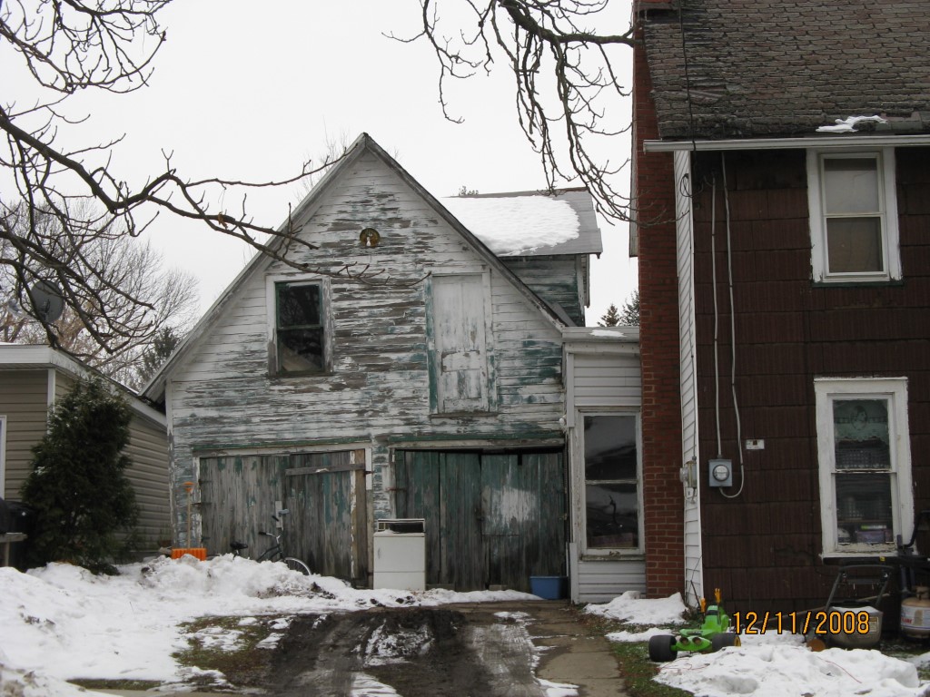
Other Buildings & Yards
No OBY Data Found
Sales History
Sale Date
Type
Price
Book / Page
Other Info
4/30/1999
LAND & BUILDING
29000
0633 / 0987
Parcel Sketches
Residential Card 1
A
MAIN
880 square feet
B
OFP OPEN FRAME PORCH
20 square feet
C
EFP ENCL FRAME PORCH
44 square feet
D
FR GR FRAME GARAGE
190 square feet
E
EFP ENCL FRAME PORCH
60 square feet
Parcel Images
Please note:
this tab is for informational purposes only and may not show all delinquencies, see the Taxes tab for more accurate delinquent taxes due.