Elected Officials
Courts
Departments
Initiatives
Open Government
About
Login / Register
Home
/
Property & Tax Records
/
Property Records
/
Property & Tax Search
/
Parcel Profile
/
Print View
Search for Another Parcel
Parcel Profile
Historical Card
Sketches
Photos
Tax Map
Taxes
Print View
Print This Page
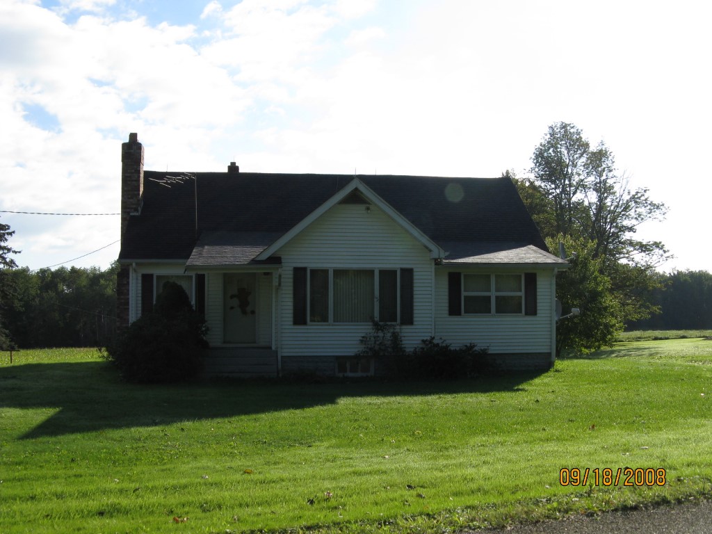
Address: 15033 KIMBALL HILL RD
Parcel: 43001005001100
Parcel Profile
Address
15033 | KIMBALL HILL | RD
Street Status
PAVED
School District
UNION CITY AREA SCHOOL
Acreage
8.6690
Classification
R
Land Use Code
SINGLE FAMILY
Legal Description
15033 KIMBALL HILL RD 8.669 AC
Square Feet
1644
Topo
ROLLING
Utility
WELL | SEPTIC
Zoning
Please contact your municipal zoning officer
Deed Book
0616
Deed Page
1985
2026 Tax Values
Land Value / Taxable
31,800 / 31,800.00
Building Value / Taxable
63,840 / 63,840.00
Total Value / Taxable
95,640 / 95,640.00
Clean & Green
Inactive
Homestead Status
Inactive
Farmstead Status
Inactive
Lerta Amount
0
Lerta Expiration Year
0
Residential Data
Card 1
Style
BUNGALOW
Basement
FULL
Year Built
1930
Exterior Wall
ALUMINUM/VINYL
Total Living Area
1644
Full Baths
1
Half Baths
0
Fuel Type
GAS
Heating
CENTRAL
Heating System
FORCED AIR
Stories
1.0
Total Bedrooms
3
Total Family Rooms
0
Total Rooms
5
Fireplaces
0
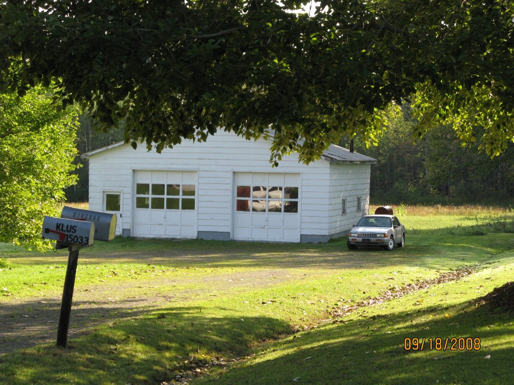
Other Buildings & Yards
Description
Built
Width
Length
Area
FRAME OR CB DETACHED GARAGE
1960
36
36
1296
Sales History
Sale Date
Type
Price
Book / Page
Other Info
2/9/1999
0
0616 / 1985
Parcel Sketches
Residential Card 1
A
MAIN
676 square feet
B
1S FR ONE STORY FRAME
96 square feet
C
UNFIN BSMT BASEMENT UNFINISHED 1S FR ONE STORY FRAME
154 square feet
D
OFP OPEN FRAME PORCH
25 square feet
E
1S FR ONE STORY FRAME
36 square feet
F
WDDCK WOOD DECKS
152 square feet
G
1S FR ONE STORY FRAME
48 square feet
H
FR GR FRAME GARAGE 1S FR ONE STORY FRAME
364 square feet
Parcel Images
Please note:
this tab is for informational purposes only and may not show all delinquencies, see the Taxes tab for more accurate delinquent taxes due.