Elected Officials
Courts
Departments
Initiatives
Open Government
About
Login / Register
Home
/
Property & Tax Records
/
Property Records
/
Property & Tax Search
/
Parcel Profile
/
Print View
Search for Another Parcel
Parcel Profile
Historical Card
Sketches
Photos
Tax Map
Taxes
Print View
Print This Page
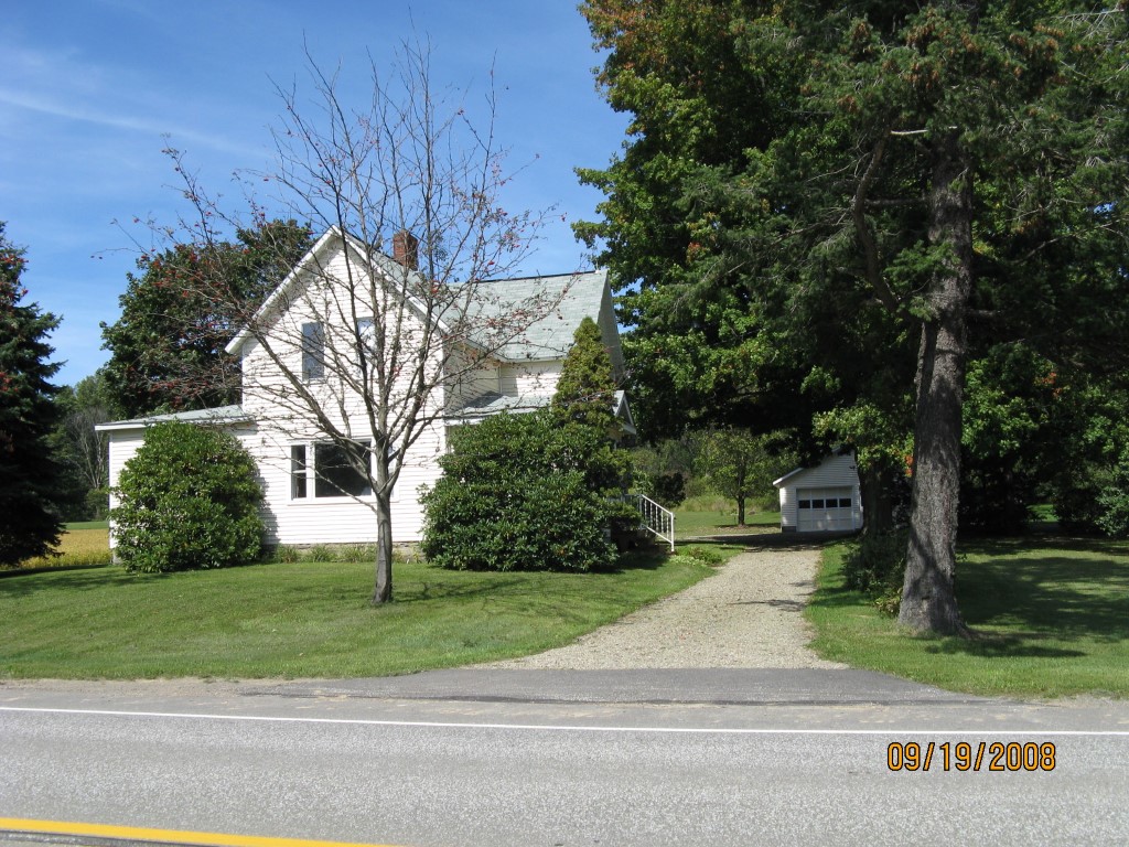
Address: 10222 ROUTE 6
Parcel: 43004012000800
Parcel Profile
Address
10222 | ROUTE 6
Street Status
PAVED
School District
UNION CITY AREA SCHOOL
Acreage
11.7500
Classification
F
Land Use Code
10-19.99 ACRES
Legal Description
10222 ROUTE 6 11.75 AC
Square Feet
1726
Topo
ROLLING
Utility
WELL | SEPTIC
Zoning
Please contact your municipal zoning officer
Deed Book
2014
Deed Page
027232
2026 Tax Values
Land Value / Taxable
29,000 / 23,900.00
Building Value / Taxable
72,640 / 72,640.00
Total Value / Taxable
101,640 / 96,540.00
Clean & Green
Active
Homestead Status
Active
Farmstead Status
Inactive
Lerta Amount
0
Lerta Expiration Year
0
Residential Data
Card 1
Style
OLD STYLE
Basement
FULL
Year Built
1900
Exterior Wall
ALUMINUM/VINYL
Total Living Area
1726
Full Baths
1
Half Baths
1
Fuel Type
OIL
Heating
CENTRAL
Heating System
FORCED AIR
Stories
1.5
Total Bedrooms
3
Total Family Rooms
1
Total Rooms
9
Fireplaces
0
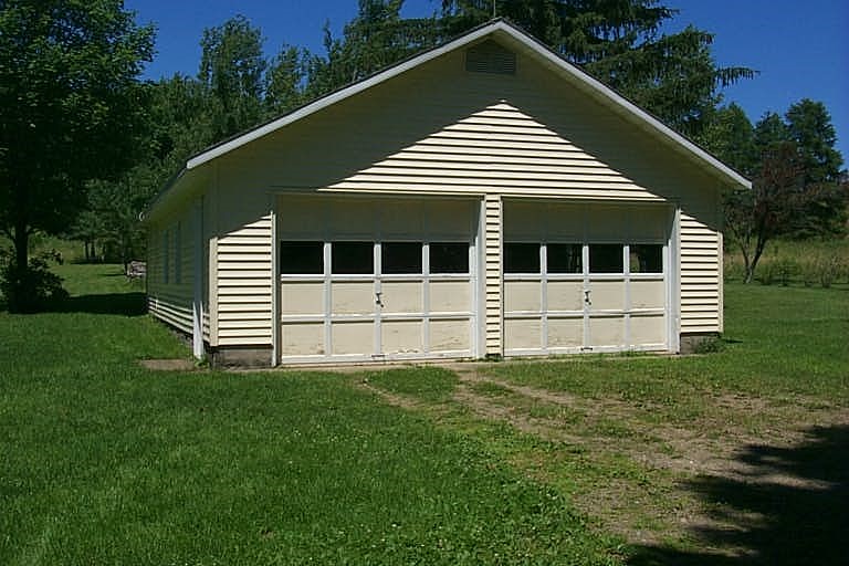
Other Buildings & Yards
No OBY Data Found
Sales History
Sale Date
Type
Price
Book / Page
Other Info
12/18/2014
LAND & BUILDING
0
2014 / 027232
SPECIAL WARRANTY DEED
1/1/1969
0
0802 / 0216
Parcel Sketches
Residential Card 1
A
MAIN
602 square feet
B
OFP OPEN FRAME PORCH
140 square feet
C
1S FR ONE STORY FRAME
168 square feet
D
OFP OPEN FRAME PORCH
112 square feet
E
UNFIN BSMT BASEMENT UNFINISHED 1S FR ONE STORY FRAME 1/2FR FRAME HALF-STORY
288 square feet
Parcel Images
Please note:
this tab is for informational purposes only and may not show all delinquencies, see the Taxes tab for more accurate delinquent taxes due.