Elected Officials
Courts
Departments
Initiatives
Open Government
About
Login / Register
Home
/
Property & Tax Records
/
Property Records
/
Property & Tax Search
/
Parcel Profile
/
Print View
Search for Another Parcel
Parcel Profile
Historical Card
Sketches
Photos
Tax Map
Taxes
Print View
Print This Page
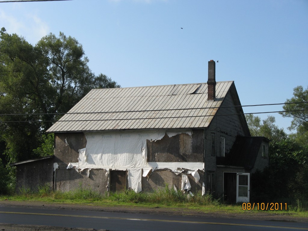
Address: WATERFORD ST
Parcel: 43010021001100
Parcel Profile
Address
0 | WATERFORD | ST
Street Status
PAVED
School District
UNION CITY AREA SCHOOL
Acreage
0.5934
Classification
C
Land Use Code
COMMERCIAL VACANT
Legal Description
WATERFORD ST 235 X 110 IRR
Topo
BELOW STREET | ROLLING | SWAMPY
Utility
NONE
Zoning
Please contact your municipal zoning officer
Deed Book
1314
Deed Page
0846
2026 Tax Values
Land Value / Taxable
7,100 / 7,100.00
Building Value / Taxable
0 / 0.00
Total Value / Taxable
7,100 / 7,100.00
Clean & Green
Inactive
Homestead Status
Inactive
Farmstead Status
Inactive
Lerta Amount
0
Lerta Expiration Year
0
Other Buildings & Yards
No OBY Data Found
Sales History
Sale Date
Type
Price
Book / Page
Other Info
3/22/2006
LAND
8000
1314 / 0846
DEED
3/3/2006
LAND
0
1310 / 1255
DEED
1/8/1987
0
1665 / 0178
Parcel Sketches
Invalid Parcel Number or No Sketches on File
Parcel Images
Please note:
this tab is for informational purposes only and may not show all delinquencies, see the Taxes tab for more accurate delinquent taxes due.