Elected Officials
Courts
Departments
Initiatives
Open Government
About
Login / Register
Home
/
Property & Tax Records
/
Property Records
/
Property & Tax Search
/
Parcel Profile
/
Print View
Search for Another Parcel
Parcel Profile
Historical Card
Sketches
Photos
Tax Map
Taxes
Print View
Print This Page
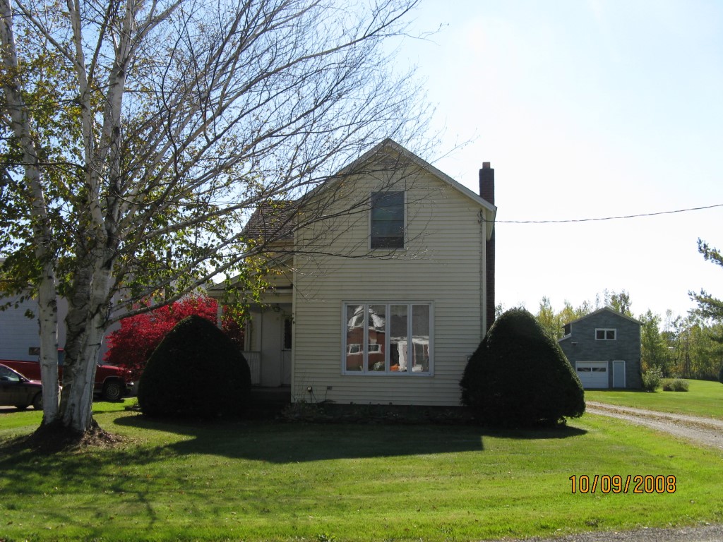
Address: 8377 W HIGH ST EXT
Parcel: 43010023000600
Parcel Profile
Address
8377 | W | HIGH ST | EXT
Street Status
PAVED
School District
UNION CITY AREA SCHOOL
Acreage
0.2296
Classification
R
Land Use Code
SINGLE FAMILY
Legal Description
8377 W HIGH ST EXT 50 X 200
Square Feet
1313
Topo
LEVEL
Utility
ALL PUBLIC
Zoning
Please contact your municipal zoning officer
Deed Book
2024
Deed Page
007927
2026 Tax Values
Land Value / Taxable
13,500 / 13,500.00
Building Value / Taxable
50,600 / 50,600.00
Total Value / Taxable
64,100 / 64,100.00
Clean & Green
Inactive
Homestead Status
Inactive
Farmstead Status
Inactive
Lerta Amount
0
Lerta Expiration Year
0
Residential Data
Card 1
Style
CAPE
Basement
FULL
Year Built
1928
Exterior Wall
ALUMINUM/VINYL
Total Living Area
1313
Full Baths
1
Half Baths
0
Fuel Type
GAS
Heating
CENTRAL
Heating System
FORCED AIR
Stories
1.5
Total Bedrooms
3
Total Family Rooms
0
Total Rooms
6
Fireplaces
0
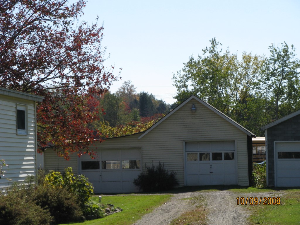
Other Buildings & Yards
Description
Built
Width
Length
Area
FRAME OR CB DETACHED GARAGE
1940
32
22
704
Sales History
Sale Date
Type
Price
Book / Page
Other Info
5/28/2024
LAND & BUILDING
0
2024 / 007927
SPECIAL WARRANTY DEED
4/24/2024
LAND & BUILDING
0
2024 / 006041
SPECIAL WARRANTY DEED
7/8/2019
LAND & BUILDING
340000
2019 / 012937
SPECIAL WARRANTY DEED
5/24/2013
LAND & BUILDING
80000
2013 / 012882
DEED
1/1/1963
0
0878 / 0176
Parcel Sketches
Residential Card 1
A
MAIN
476 square feet
B
OFP OPEN FRAME PORCH
96 square feet
C
EFP ENCL FRAME PORCH
84 square feet
D
WDDCK WOOD DECKS
272 square feet
E
MA STOOP/TERR MAS STOOP
42 square feet
F
1S FR ONE STORY FRAME
480 square feet
Parcel Images
Please note:
this tab is for informational purposes only and may not show all delinquencies, see the Taxes tab for more accurate delinquent taxes due.