Elected Officials
Courts
Departments
Initiatives
Open Government
About
Login / Register
Home
/
Property & Tax Records
/
Property Records
/
Property & Tax Search
/
Parcel Profile
/
Print View
Search for Another Parcel
Parcel Profile
Historical Card
Sketches
Photos
Tax Map
Taxes
Print View
Print This Page
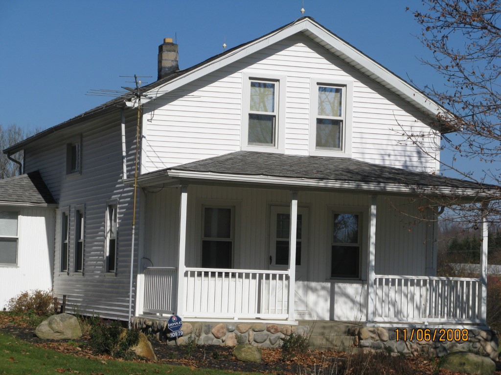
Address: 10979 ROUTE 8
Parcel: 44008017001900
Parcel Profile
Address
10979 | ROUTE 8
Street Status
PAVED
School District
WATTSBURG SCHOOL
Acreage
12.2660
Classification
F
Land Use Code
10-19.99 ACRES
Legal Description
10979 ROUTE 8 12.266 AC
Square Feet
1484
Topo
LEVEL
Utility
WELL | SEPTIC
Zoning
Please contact your municipal zoning officer
Deed Book
1304
Deed Page
0809
2026 Tax Values
Land Value / Taxable
38,800 / 7,900.00
Building Value / Taxable
82,960 / 82,960.00
Total Value / Taxable
121,760 / 90,860.00
Clean & Green
Active
Homestead Status
Active
Farmstead Status
Inactive
Lerta Amount
0
Lerta Expiration Year
0
Residential Data
Card 1
Style
OLD STYLE
Basement
FULL
Year Built
1910
Exterior Wall
ALUMINUM/VINYL
Total Living Area
1484
Full Baths
1
Half Baths
0
Fuel Type
OIL
Heating
CENTRAL
Heating System
FORCED AIR
Stories
1.5
Total Bedrooms
2
Total Family Rooms
1
Total Rooms
6
Fireplaces
0
Other Buildings & Yards
Description
Built
Width
Length
Area
FRAME OR CB DETACHED GARAGE
1995
22
24
528
FOUR SIDE CLOSED MTL POLE BLDG
2017
40
48
1920
1S LEAN TO
2017
12
40
480
Sales History
Sale Date
Type
Price
Book / Page
Other Info
2/3/2006
LAND & BUILDING
139000
1304 / 0809
WARRANTY/SURVIVORSHIP DEED
1/1/1969
0
0495 / 0443
Parcel Sketches
Residential Card 1
A
MAIN
720 square feet
B
EFP ENCL FRAME PORCH
40 square feet
C
UNFIN BSMT BASEMENT UNFINISHED 1S FR ONE STORY FRAME
224 square feet
D
EFP ENCL FRAME PORCH
88 square feet
E
OFP OPEN FRAME PORCH
160 square feet
Parcel Images
Please note:
this tab is for informational purposes only and may not show all delinquencies, see the Taxes tab for more accurate delinquent taxes due.