Elected Officials
Courts
Departments
Initiatives
Open Government
About
Login / Register
Home
/
Property & Tax Records
/
Property Records
/
Property & Tax Search
/
Parcel Profile
/
Print View
Search for Another Parcel
Parcel Profile
Historical Card
Sketches
Photos
Tax Map
Taxes
Print View
Print This Page
Address: COMER RD
Parcel: 45003005000800
Parcel Profile
Address
0 | COMER | RD
Street Status
PAVED
School District
GENERAL MCLANE SCHOOL
Acreage
128.8900
Classification
F
Land Use Code
OUT BUILDINGS ONLY: NOT LIVING UNITS
Legal Description
COMER ROAD TR 410 & 412 | 128.89 AC
Topo
LEVEL
Utility
NONE
Zoning
Please contact your municipal zoning officer
Deed Book
2016
Deed Page
027814
2026 Tax Values
Land Value / Taxable
128,100 / 83,300.00
Building Value / Taxable
2,400 / 2,400.00
Total Value / Taxable
130,500 / 85,700.00
Clean & Green
Active
Homestead Status
Inactive
Farmstead Status
Inactive
Lerta Amount
0
Lerta Expiration Year
0
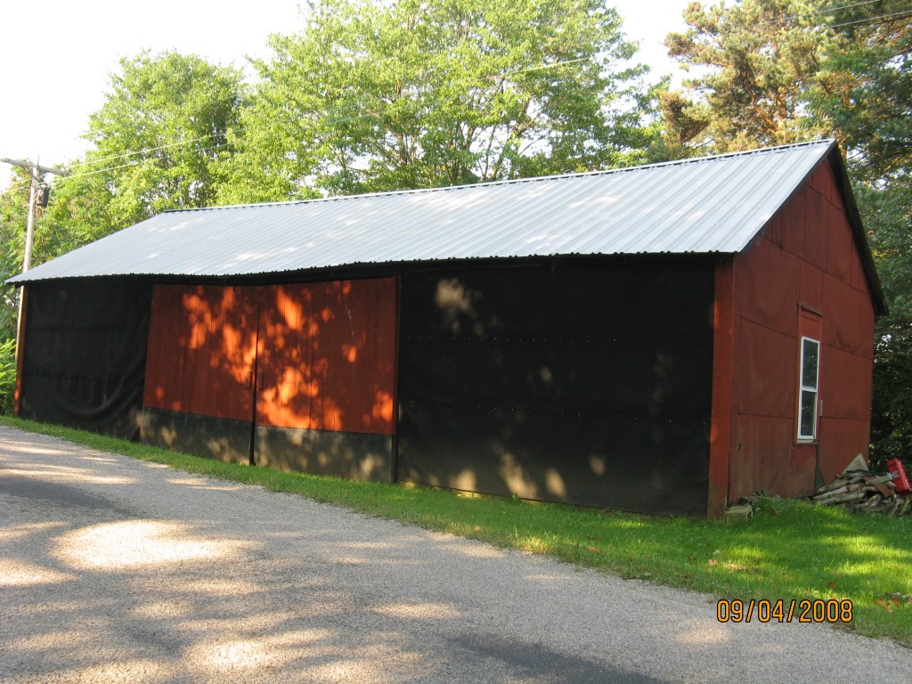
Other Buildings & Yards
Description
Built
Width
Length
Area
FRAME UTILITY SHED
1920
12
16
192
FRAME UTILITY SHED
1920
20
40
800
Sales History
Sale Date
Type
Price
Book / Page
Other Info
12/21/2016
LAND & BUILDING
0
2016 / 027814
QUIT CLAIM DEED
6/9/1972
0
1070 / 0299
Parcel Sketches
Invalid Parcel Number or No Sketches on File
Parcel Images
Please note:
this tab is for informational purposes only and may not show all delinquencies, see the Taxes tab for more accurate delinquent taxes due.