Elected Officials
Courts
Departments
Initiatives
Open Government
About
Login / Register
Home
/
Property & Tax Records
/
Property Records
/
Property & Tax Search
/
Parcel Profile
/
Print View
Search for Another Parcel
Parcel Profile
Historical Card
Sketches
Photos
Tax Map
Taxes
Print View
Print This Page
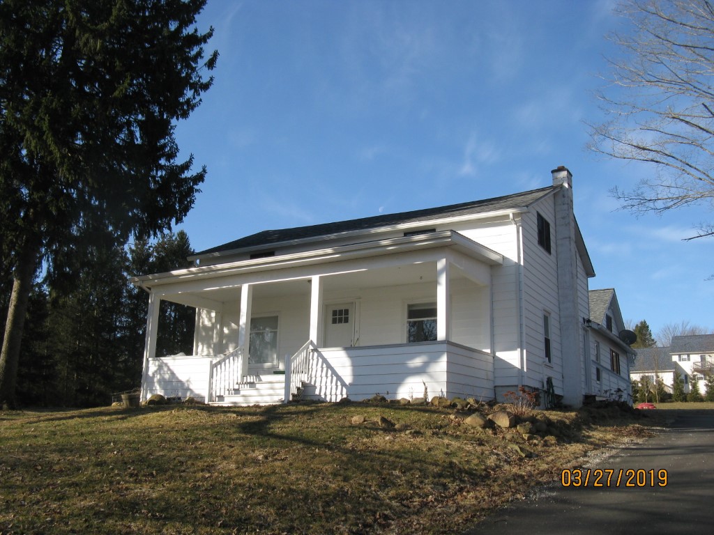
Address: 12290 ANGLING RD
Parcel: 45034038101900
Parcel Profile
Address
12290 | ANGLING | RD
Street Status
PAVED
School District
GENERAL MCLANE SCHOOL
Acreage
3.0080
Classification
R
Land Use Code
SINGLE FAMILY
Legal Description
12290 ANGLING RD LOT B 3.008 AC NET
Square Feet
1772
Topo
ABOVE STREET
Utility
GAS | WELL | PUBLIC SEWER
Zoning
Please contact your municipal zoning officer
Deed Book
2016
Deed Page
020240
2026 Tax Values
Land Value / Taxable
44,400 / 44,400.00
Building Value / Taxable
84,900 / 84,900.00
Total Value / Taxable
129,300 / 129,300.00
Clean & Green
Inactive
Homestead Status
Active
Farmstead Status
Inactive
Lerta Amount
0
Lerta Expiration Year
0
Residential Data
Card 1
Style
OLD STYLE
Basement
PART
Year Built
1900
Exterior Wall
ALUMINUM/VINYL
Total Living Area
1772
Full Baths
1
Half Baths
0
Fuel Type
OIL
Heating
CENTRAL
Heating System
FORCED AIR
Stories
1.5
Total Bedrooms
4
Total Family Rooms
1
Total Rooms
7
Fireplaces
0
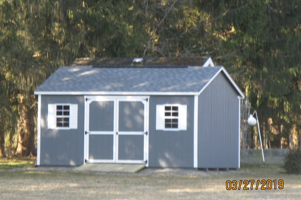
Other Buildings & Yards
Description
Built
Width
Length
Area
FRAME UTILITY SHED
2018
16
12
192
Sales History
Sale Date
Type
Price
Book / Page
Other Info
9/19/2016
LAND & BUILDING
150000
2016 / 020240
DEED
6/30/2009
LAND & BUILDING
70000
1573 / 0658
FIDUCIARY DEED
7/5/1995
0
0391 / 0978
Parcel Sketches
Residential Card 1
A
MAIN
736 square feet
B
OFP OPEN FRAME PORCH
243 square feet
C
EFP ENCL FRAME PORCH
220 square feet
D
1S FR ONE STORY FRAME
484 square feet
E
FR GR FRAME GARAGE AT UN ATTIC-UNFINISHED
672 square feet
F
WDDCK WOOD DECKS
361 square feet
Parcel Images
Please note:
this tab is for informational purposes only and may not show all delinquencies, see the Taxes tab for more accurate delinquent taxes due.