Elected Officials
Courts
Departments
Initiatives
Open Government
About
Login / Register
Home
/
Property & Tax Records
/
Property Records
/
Property & Tax Search
/
Parcel Profile
/
Print View
Search for Another Parcel
Parcel Profile
Historical Card
Sketches
Photos
Tax Map
Taxes
Print View
Print This Page
Address: CHESTNUT ST
Parcel: 46006027001500
Parcel Profile
Address
0 | CHESTNUT | ST
Street Status
PAVED
School District
FORT LEBOEUF SCHOOL
Acreage
0.0665
Classification
R
Land Use Code
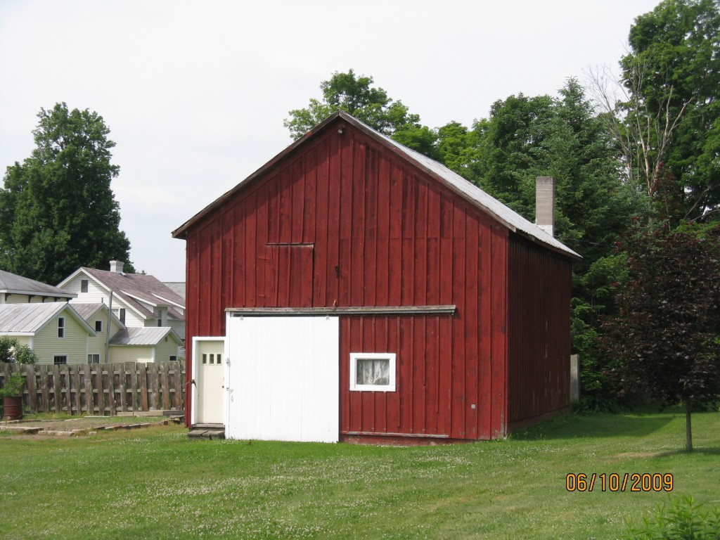
OUTBUILDINGS ONLY; NO LIVING UNITS
Legal Description
CHESTNUT ST LS 225 226 | 21X137.
Topo
LEVEL
Utility
NONE
Zoning
Please contact your municipal zoning officer
Deed Book
2014
Deed Page
015221
2026 Tax Values
Land Value / Taxable
17,300 / 17,300.00
Building Value / Taxable
800 / 800.00
Total Value / Taxable
18,100 / 18,100.00
Clean & Green
Inactive
Homestead Status
Inactive
Farmstead Status
Inactive
Lerta Amount
0
Lerta Expiration Year
0
Other Buildings & Yards
Description
Built
Width
Length
Area
FLAT BARN
1900
26
30
780
Sales History
Sale Date
Type
Price
Book / Page
Other Info
7/24/2014
LAND & BUILDING
20000
2014 / 015221
SPECIAL WARRANTY DEED
4/8/2004
LAND & BUILDING
0
1123 / 0208
QUIT CLAIM DEED
8/25/1978
0
1318 / 0112
Parcel Sketches
Invalid Parcel Number or No Sketches on File
Parcel Images
Please note:
this tab is for informational purposes only and may not show all delinquencies, see the Taxes tab for more accurate delinquent taxes due.