Elected Officials
Courts
Departments
Initiatives
Open Government
About
Login / Register
Home
/
Property & Tax Records
/
Property Records
/
Property & Tax Search
/
Parcel Profile
/
Print View
Search for Another Parcel
Parcel Profile
Historical Card
Sketches
Photos
Tax Map
Taxes
Print View
Print This Page
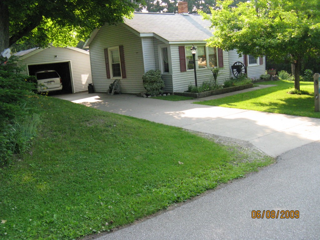
Address: 27 CHESTNUT ST
Parcel: 46009060000200
Parcel Profile
Address
27 | CHESTNUT | ST
Street Status
PAVED
School District
FORT LEBOEUF SCHOOL
Acreage
0.1297
Classification
R
Land Use Code
SINGLE FAMILY
Legal Description
27 CHESTNUT ST 50 X 113
Square Feet
1060
Topo
LEVEL
Utility
ALL PUBLIC
Zoning
Please contact your municipal zoning officer
Deed Book
2023
Deed Page
013197
2026 Tax Values
Land Value / Taxable
24,700 / 24,700.00
Building Value / Taxable
41,340 / 41,340.00
Total Value / Taxable
66,040 / 66,040.00
Clean & Green
Inactive
Homestead Status
Inactive
Farmstead Status
Inactive
Lerta Amount
0
Lerta Expiration Year
0
Residential Data
Card 1
Style
BUNGALOW
Basement
NONE
Year Built
1900
Exterior Wall
ALUMINUM/VINYL
Total Living Area
1060
Full Baths
1
Half Baths
0
Fuel Type
GAS
Heating
CENTRAL
Heating System
FORCED AIR
Stories
1.0
Total Bedrooms
2
Total Family Rooms
0
Total Rooms
4
Fireplaces
0
Other Buildings & Yards
No OBY Data Found
Sales History
Sale Date
Type
Price
Book / Page
Other Info
8/10/2023
LAND & BUILDING
0
2023 / 013197
FIDUCIARY DEED
11/5/1962
0
0867 / 0532
Parcel Sketches
Residential Card 1
A
MAIN
576 square feet
B
1S FR ONE STORY FRAME
104 square feet
C
1S FR ONE STORY FRAME
324 square feet
D
OFP OPEN FRAME PORCH
40 square feet
E
1S FR ONE STORY FRAME
56 square feet
Parcel Images
Please note:
this tab is for informational purposes only and may not show all delinquencies, see the Taxes tab for more accurate delinquent taxes due.