Elected Officials
Courts
Departments
Initiatives
Open Government
About
Login / Register
Home
/
Property & Tax Records
/
Property Records
/
Property & Tax Search
/
Parcel Profile
/
Print View
Search for Another Parcel
Parcel Profile
Historical Card
Sketches
Photos
Tax Map
Taxes
Print View
Print This Page
Address: HIGH ST
Parcel: 46010050001000
Parcel Profile
Address
0 | HIGH | ST
Street Status
PAVED | SIDEWALK
School District
FORT LEBOEUF SCHOOL
Acreage
0.0445
Classification
C
Land Use Code
RESTAURANTS, STORES (RETAIL)
Legal Description
SW HIGH ST | 20.5 X 94.5
Square Feet
3220
Topo
LEVEL
Utility
ALL PUBLIC
Zoning
Please contact your municipal zoning officer
Deed Book
2018
Deed Page
012544
2026 Tax Values
Land Value / Taxable
5,800 / 5,800.00
Building Value / Taxable
52,700 / 52,700.00
Total Value / Taxable
58,500 / 58,500.00
Clean & Green
Inactive
Homestead Status
Inactive
Farmstead Status
Inactive
Lerta Amount
0
Lerta Expiration Year
0
Commercial Data
Card 1
DOWNTOWN ROW TYPE
Business Living Area - 3220
Year Built - 1900
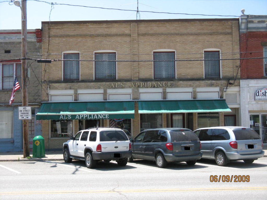
Improvement Name - AL'S APPLIANCE
Value - 52710
Other Buildings & Yards
No OBY Data Found
Sales History
Sale Date
Type
Price
Book / Page
Other Info
6/26/2018
LAND & BUILDING
72605
2018 / 012544
FIDUCIARY DEED
2/6/2009
LAND & BUILDING
0
1542 / 0954
QUIT CLAIM DEED
5/13/1977
0
1263 / 0224
Parcel Sketches
Commercial Card 1
A
MAIN
805 square feet
B
MAIN
1610 square feet
C
MAIN
1610 square feet
Parcel Images
Please note:
this tab is for informational purposes only and may not show all delinquencies, see the Taxes tab for more accurate delinquent taxes due.