Elected Officials
Courts
Departments
Initiatives
Open Government
About
Login / Register
Home
/
Property & Tax Records
/
Property Records
/
Property & Tax Search
/
Parcel Profile
/
Print View
Search for Another Parcel
Parcel Profile
Historical Card
Sketches
Photos
Tax Map
Taxes
Print View
Print This Page
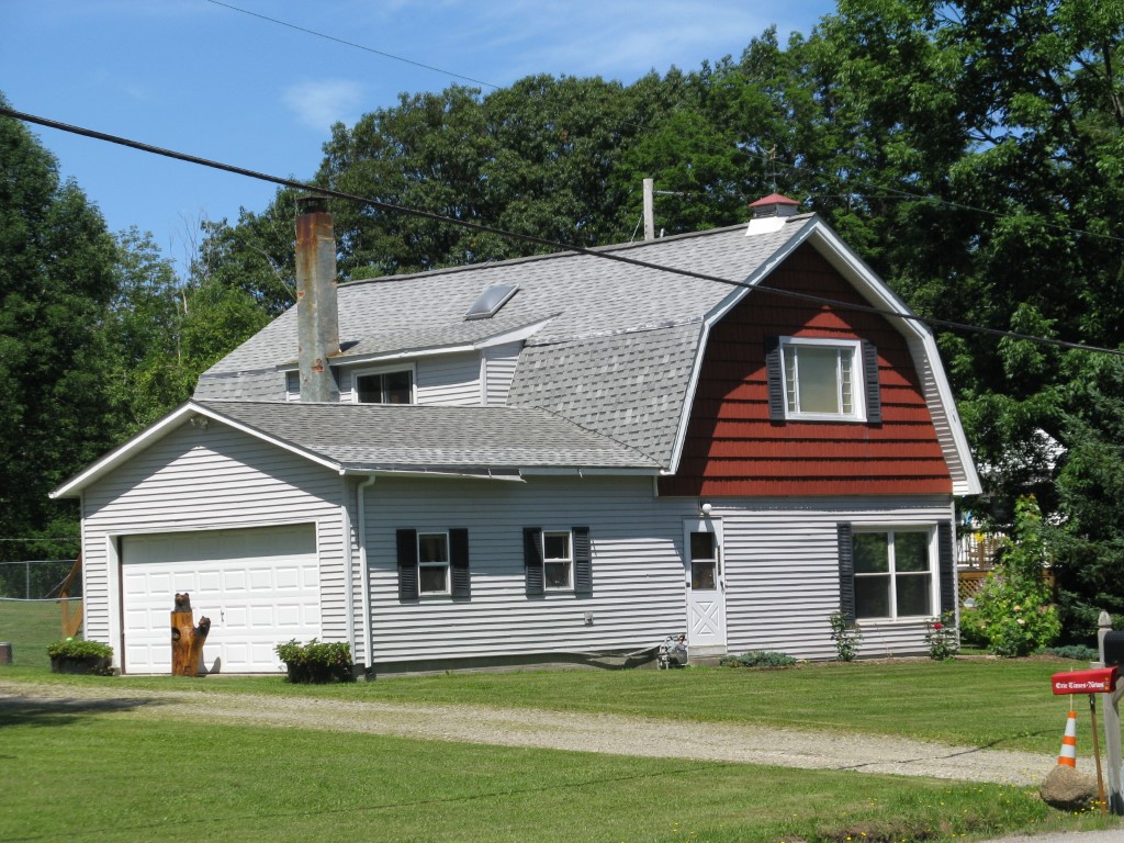
Address: 10754 ROUTE 19 N
Parcel: 47011005001400
Parcel Profile
Address
10754 | ROUTE 19 N
Street Status
PAVED
School District
FORT LEBOEUF SCHOOL
Acreage
1.3700
Classification
R
Land Use Code
SINGLE FAMILY
Legal Description
10754 ROUTE 19 1.37 AC CAL
Square Feet
1920
Topo
LEVEL
Utility
GAS | WELL | SEPTIC
Zoning
Please contact your municipal zoning officer
Deed Book
0556
Deed Page
2193
2026 Tax Values
Land Value / Taxable
29,300 / 29,300.00
Building Value / Taxable
83,100 / 83,100.00
Total Value / Taxable
112,400 / 112,400.00
Clean & Green
Inactive
Homestead Status
Active
Farmstead Status
Inactive
Lerta Amount
0
Lerta Expiration Year
0
Residential Data
Card 1
Style
OLD STYLE
Basement
NONE
Year Built
1930
Exterior Wall
ALUMINUM/VINYL
Total Living Area
1920
Full Baths
1
Half Baths
0
Fuel Type
GAS
Heating
CENTRAL
Heating System
FORCED AIR
Stories
2.0
Total Bedrooms
3
Total Family Rooms
0
Total Rooms
5
Fireplaces
0
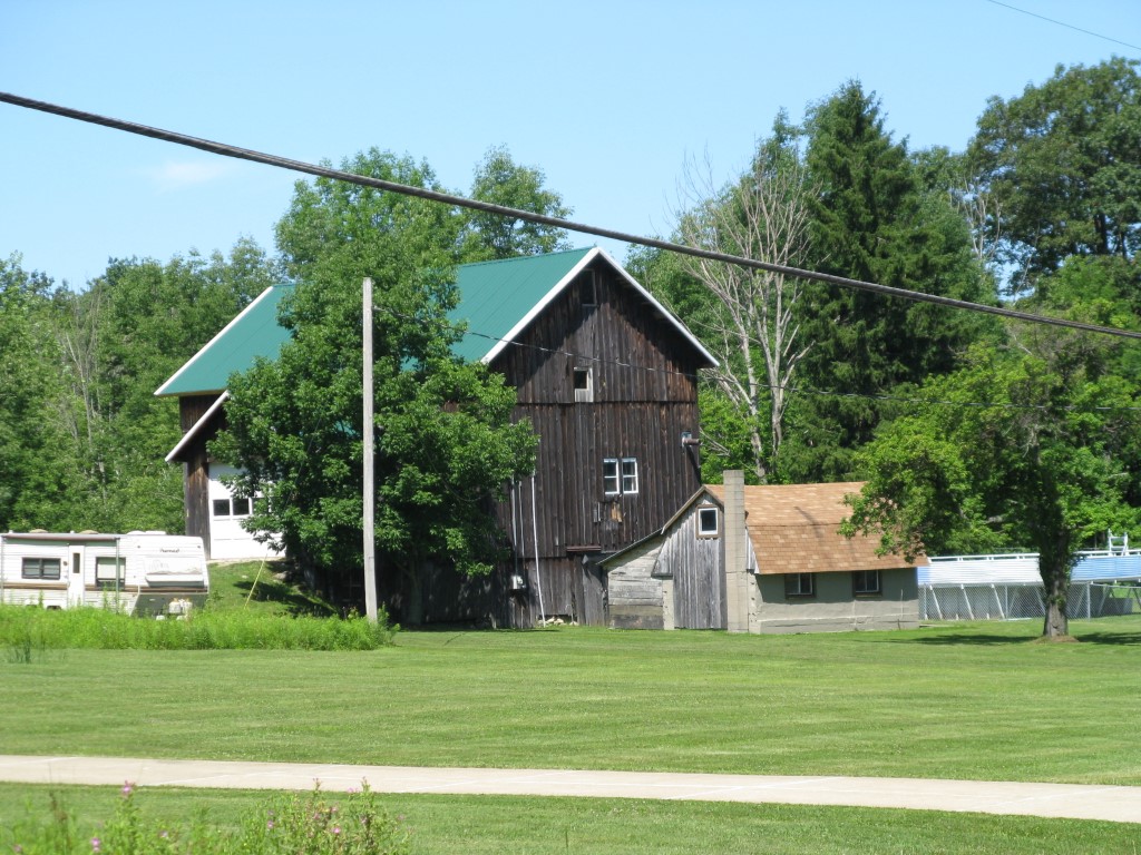
Other Buildings & Yards
Description
Built
Width
Length
Area
BANK BARN
1930
32
40
1280
1S LEAN TO
1930
12
16
192
1S LEAN TO
1940
23
10
230
FRAME UTILITY SHED
1940
10
10
100
CONCRET PATIO, DETACHED
1950
0
0
80
CANOPY
1950
5
20
100
Sales History
Sale Date
Type
Price
Book / Page
Other Info
4/27/1998
LAND & BUILDING
79400
0556 / 2193
Parcel Sketches
Residential Card 1
A
MAIN
960 square feet
B
MA_PT CONC/MAS PATIO
144 square feet
C
FR GR FRAME GARAGE
400 square feet
D
MA_PT CONC/MAS PATIO
332 square feet
E
MA_PT CONC/MAS PATIO WDDCK WOOD DECKS
100 square feet
Parcel Images
Please note:
this tab is for informational purposes only and may not show all delinquencies, see the Taxes tab for more accurate delinquent taxes due.