Elected Officials
Courts
Departments
Initiatives
Open Government
About
Login / Register
Home
/
Property & Tax Records
/
Property Records
/
Property & Tax Search
/
Parcel Profile
/
Print View
Search for Another Parcel
Parcel Profile
Historical Card
Sketches
Photos
Tax Map
Taxes
Print View
Print This Page
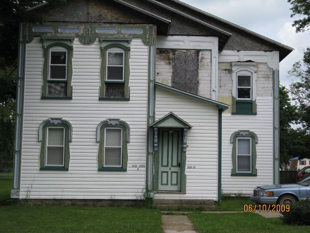
Address: 9630 32 JAMESTOWN ST
Parcel: 48001002001900
Parcel Profile
Address
9630 | 32 | JAMESTOWN | ST
Street Status
PAVED | SIDEWALK
School District
WATTSBURG SCHOOL
Acreage
0.4800
Classification
A
Land Use Code
APARTMENTS 4 - 19 UNITS
Legal Description
9630 32 JAMESTOWN ST 118 X 175 IR
Square Feet
4070
Topo
LEVEL
Utility
GAS | WELL | SEPTIC
Zoning
Please contact your municipal zoning officer
Deed Book
2011
Deed Page
017109
2026 Tax Values
Land Value / Taxable
39,200 / 39,200.00
Building Value / Taxable
15,800 / 15,800.00
Total Value / Taxable
55,000 / 55,000.00
Clean & Green
Inactive
Homestead Status
Inactive
Farmstead Status
Inactive
Lerta Amount
0
Lerta Expiration Year
0
Commercial Data
Card 1
MIXED RESIDENTIAL/COMMERCIAL
Business Living Area - 4070
Year Built - 1877
Improvement Name - 5 UNIT APARTMENT BUILDING
Value - 27850
Other Buildings & Yards
No OBY Data Found
Sales History
Sale Date
Type
Price
Book / Page
Other Info
1/19/1999
LAND & BUILDING
55000
2011 / 017109
WARRANTY/SURVIVORSHIP DEED
1/19/1999
0
0612 / 1687
Parcel Sketches
Commercial Card 1
A
MAIN
816 square feet
B
MAIN
1598 square feet
C
MAIN
1104 square feet
D
MAIN
552 square feet
Parcel Images
Please note:
this tab is for informational purposes only and may not show all delinquencies, see the Taxes tab for more accurate delinquent taxes due.