Elected Officials
Courts
Departments
Initiatives
Open Government
About
Login / Register
Home
/
Property & Tax Records
/
Property Records
/
Property & Tax Search
/
Parcel Profile
/
Print View
Search for Another Parcel
Parcel Profile
Historical Card
Sketches
Photos
Tax Map
Taxes
Print View
Print This Page
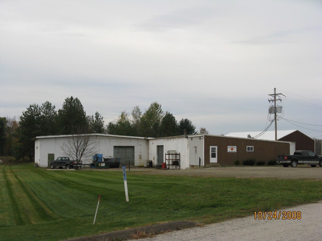
Address: 120 PLASTICS RD
Parcel: 06047035100200
Parcel Profile
Address
120 | PLASTICS | RD
Street Status
PAVED
School District
CORRY AREA SCHOOL
Acreage
0.9682
Classification
C
Land Use Code
WAREHOUSES
Legal Description
120 PLASTICS RD 140.59 X 300
Square Feet
9240
Topo
LEVEL
Utility
ALL PUBLIC
Zoning
Please contact your municipal zoning officer
Deed Book
1593
Deed Page
1039
2026 Tax Values
Land Value / Taxable
19,400 / 19,400.00
Building Value / Taxable
90,600 / 90,600.00
Total Value / Taxable
110,000 / 110,000.00
Clean & Green
Inactive
Homestead Status
Inactive
Farmstead Status
Inactive
Lerta Amount
0
Lerta Expiration Year
0
Commercial Data
Card 1
WAREHOUSE
Business Living Area - 9240
Year Built - 1981
Improvement Name - CORNERSTONE TOOL AND DIE
Value - 90590
Other Buildings & Yards
No OBY Data Found
Sales History
Sale Date
Type
Price
Book / Page
Other Info
9/25/2009
LAND & BUILDING
50000
1593 / 1039
WARRANTY/SURVIVORSHIP DEED
7/14/2004
LAND & BUILDING
85000
1154 / 0866
WARRANTY/SURVIVORSHIP DEED
10/30/1998
LAND & BUILDING
91000
598 / 1431
Parcel Sketches
Commercial Card 1
A
MAIN
9240 square feet
Parcel Images
Please note:
this tab is for informational purposes only and may not show all delinquencies, see the Taxes tab for more accurate delinquent taxes due.