Elected Officials
Courts
Departments
Initiatives
Open Government
About
Login / Register
Home
/
Property & Tax Records
/
Property Records
/
Property & Tax Search
/
Parcel Profile
/
Print View
Search for Another Parcel
Parcel Profile
Historical Card
Sketches
Photos
Tax Map
Taxes
Print View
Print This Page
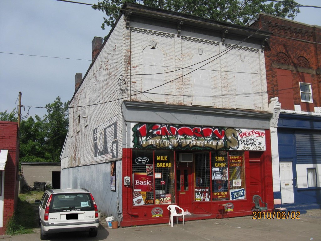
Address: 1620 PARADE ST
Parcel: 15020020020100
Parcel Profile
Address
1620 | PARADE | ST
Street Status
PAVED | SIDEWALK
School District
CITY OF ERIE SCHOOL
Acreage
0.1004
Classification
C
Land Use Code
OFFICE BLDGS/LABS/LIBRARIES
Legal Description
1620 PARADE ST 35X125
Square Feet
2691
Topo
LEVEL
Utility
ALL PUBLIC
Zoning
Please contact your municipal zoning officer
Deed Book
2025
Deed Page
001247
2026 Tax Values
Land Value / Taxable
13,100 / 13,100.00
Building Value / Taxable
23,500 / 23,500.00
Total Value / Taxable
36,600 / 36,600.00
Clean & Green
Inactive
Homestead Status
Inactive
Farmstead Status
Inactive
Lerta Amount
0
Lerta Expiration Year
0
Commercial Data
Card 1
DOWNTOWN ROW TYPE
Business Living Area - 2691
Year Built - 1890
Improvement Name - LINDSEY'S VARIETY STORE
Value - 32140
Other Buildings & Yards
Description
Built
Width
Length
Area
FRAME OR CB DETACHED GARAGE
1940
18
35
630
Sales History
Sale Date
Type
Price
Book / Page
Other Info
1/27/2025
LAND & BUILDING
80000
2025 / 001247
SPECIAL WARRANTY DEED
1/13/2022
LAND & BUILDING
0
2022 / 000968
QUIT CLAIM DEED
3/17/2010
LAND & BUILDING
15000
2010 / 005718
DEED
2/11/1994
0
0319 / 0643
1/19/1983
0
1483 / 0131
1/2/1958
0
0772 / 0544
6/5/1951
0
0595 / 0309
9/29/1945
0
0463 / 0390
Parcel Sketches
Commercial Card 1
A
MAIN
1150 square feet
B
MAIN
1541 square feet
C
MAIN
1150 square feet
Parcel Images
Please note:
this tab is for informational purposes only and may not show all delinquencies, see the Taxes tab for more accurate delinquent taxes due.