Elected Officials
Courts
Departments
Initiatives
Open Government
About
Login / Register
Home
/
Property & Tax Records
/
Property Records
/
Property & Tax Search
/
Parcel Profile
/
Print View
Search for Another Parcel
Parcel Profile
Historical Card
Sketches
Photos
Tax Map
Taxes
Print View
Print This Page
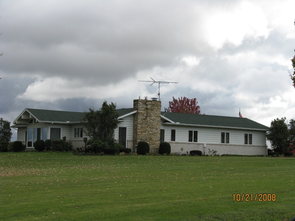
Address: 12381 FRY RD
Parcel: 45021045002700
Parcel Profile
Address
12381 | FRY | RD
Street Status
PAVED
School District
GENERAL MCLANE SCHOOL
Acreage
45.0000
Classification
F
Land Use Code
20 - 79.99 ACRES
Legal Description
12381 FRY RD 45 AC
Square Feet
2208
Topo
LEVEL
Utility
WELL | SEPTIC
Zoning
Please contact your municipal zoning officer
Deed Book
2019
Deed Page
017794
2026 Tax Values
Land Value / Taxable
125,800 / 18,200.00
Building Value / Taxable
132,290 / 132,290.00
Total Value / Taxable
258,090 / 150,490.00
Clean & Green
Active
Homestead Status
Active
Farmstead Status
Inactive
Lerta Amount
0
Lerta Expiration Year
0
Residential Data
Card 1
Style
RANCH
Basement
FULL
Year Built
1933
Exterior Wall
MASONRY & FRAME
Total Living Area
2208
Full Baths
2
Half Baths
1
Fuel Type
OIL
Heating
CENTRAL
Heating System
HOT WATER
Stories
1.0
Total Bedrooms
3
Total Family Rooms
0
Total Rooms
6
Fireplaces
1
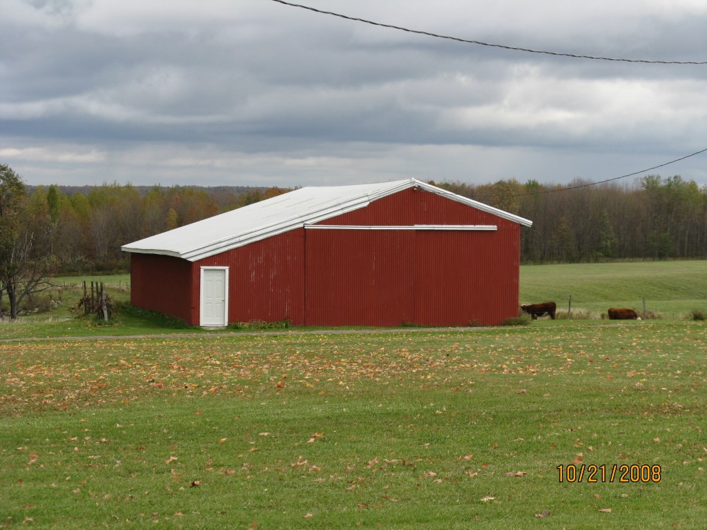
Other Buildings & Yards
Description
Built
Width
Length
Area
FOUR SIDE CLOSED MTL POLE BLDG
1973
24
65
1560
FLAT BARN
1933
36
48
1728
1S LEAN TO
1973
16
65
1040
FOUR SIDE CLOSED MTL POLE BLDG
2020
0
0
496
Sales History
Sale Date
Type
Price
Book / Page
Other Info
9/6/2019
LAND & BUILDING
294000
2019 / 017794
FIDUCIARY DEED
12/19/1991
0
0188 / 2119
Parcel Sketches
Residential Card 1
A
MAIN
2208 square feet
B
FR GR FRAME GARAGE
600 square feet
C
MA_PT CONC/MAS PATIO
242 square feet
Parcel Images
Please note:
this tab is for informational purposes only and may not show all delinquencies, see the Taxes tab for more accurate delinquent taxes due.